| Namespace | urn:xml-gov-au:icsm:egeodesy:0.4 | ||
|
Diagram
|
 |
||
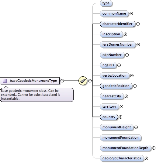
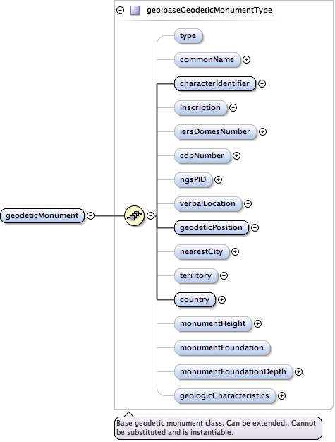
| Type | geo:baseGeodeticMonumentType | ||
| Type hierarchy |
|
||
|
Properties
|
|
||
| Substitution Group Affiliation |
|
||
|
Used by
|
|
||
| Model |
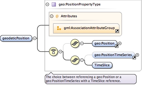
geo:type{0,1} , geo:commonName{0,1} , geo:characterIdentifier , geo:inscription{0,1} , geo:iersDomesNumber{0,1} , geo:cdpNumber{0,1} , geo:ngsPID{0,1} , geo:verbalLocation{0,1} , geo:geodeticPosition , geo:nearestCity{0,1} , geo:territory{0,1} , geo:country , geo:monumentHeight{0,1} , geo:monumentFoundation{0,1} , geo:monumentFoundationDepth{0,1} , geo:geologicCharacteristics{0,1}
|
||
| Children | geo:cdpNumber, geo:characterIdentifier, geo:commonName, geo:country, geo:geodeticPosition, geo:geologicCharacteristics, geo:iersDomesNumber, geo:inscription, geo:monumentFoundation, geo:monumentFoundationDepth, geo:monumentHeight, geo:nearestCity, geo:ngsPID, geo:territory, geo:type, geo:verbalLocation | ||
|
Instance
|
|
||
|
Source
|
|
||
| Schema location | file:/Users/boss/dev/GeodesyML/schemas/geodeticMonument.xsd |