<p>Derived from SOPAC IGS Site Log XML Schema 2011</p><ul><li>http://sopac.ucsd.edu/ns/geodesy/base/geodeticEquipment/gnssAntenna/2003/10/gnssAntenna.xsd</li><li>http://sopac.ucsd.edu/ns/geodesy/base/geodeticEquipment/gnssReceiver/2003/10/gnssReceiver.xsd</li><li>http://sopac.ucsd.edu/ns/geodesy/base/geodeticEquipment/gnssRadome/2003/10/gnssRadome.xsd</li><li>http://sopac.ucsd.edu/ns/geodesy/base/geodeticEquipment/2003/10/geodeticEquipment.xsd</li></ul><p>Modifications from original</p><ul><li>Made part of eGeodesy namespace</li><li>Combined all geodetic equipment definitions into one file</li><li>Changed baseGeodeticEquipmentType to inherit from geo:InstrumentType</li><li>Defined radome, antenna, and receiver configuration types</li></ul>
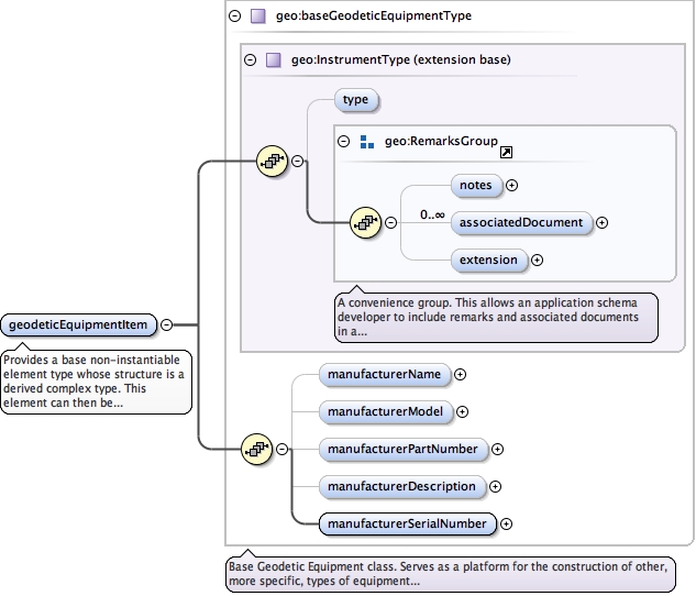
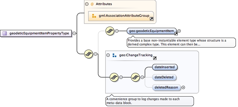
Provides a base non-instantiable element type whosestructure is a derived complex type. This elementcan then be referenced as a substitutionGroup forequipment cataloges and such.
<element abstract="false" name="geodeticEquipmentItem" type="geo:baseGeodeticEquipmentType"><annotation><documentation>Provides a base non-instantiable element type whose structure is a derived complex type. This element can then be referenced as a substitutionGroup for equipment cataloges and such.</documentation></annotation></element>
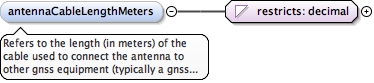
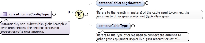
Refers to the length (in meters) of the cableused to connect the antenna to other gnss equipment(typically a gnss receiver or set of receivers).
Diagram
Type
restriction of decimal
Properties
content
simple
minOccurs
0
Facets
totalDigits
6
fractionDigits
3
Source
<element minOccurs="0" name="antennaCableLengthMeters"><annotation><documentation>Refers to the length (in meters) of the cable used to connect the antenna to other gnss equipment (typically a gnss receiver or set of receivers).</documentation></annotation><simpleType><restriction base="decimal"><totalDigits value="6"/><fractionDigits value="3"/></restriction></simpleType></element>
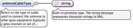
Refers to the type of cableused to connect the antenna to other gnss equipment(typically a gnss receiver or set of receivers).
Diagram
Type
string
Properties
content
simple
minOccurs
0
Source
<element minOccurs="0" name="antennaCableType" type="string"><annotation><documentation>Refers to the type of cable used to connect the antenna to other gnss equipment (typically a gnss receiver or set of receivers).</documentation></annotation></element>
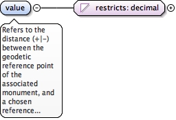
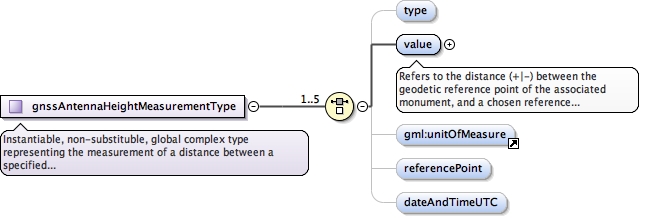
Refers to the distance (+|-) between the geodeticreference point of the associated monument, and achosen reference point on the antenna.
Diagram
Type
restriction of decimal
Properties
content
simple
Facets
totalDigits
6
fractionDigits
4
Source
<element name="value"><annotation><documentation>Refers to the distance (+|-) between the geodetic reference point of the associated monument, and a chosen reference point on the antenna.</documentation></annotation><simpleType><restriction base="decimal"><totalDigits value="6"/><fractionDigits value="4"/></restriction></simpleType></element>
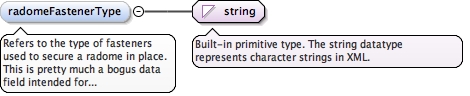
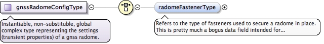
Refers to the type of fasteners used to secure a radomein place. This is pretty much a bogus data fieldintended for future compatibility purposes.
Diagram
Type
string
Properties
content
simple
minOccurs
0
Source
<element minOccurs="0" name="radomeFastenerType" type="string"><annotation><documentation>Refers to the type of fasteners used to secure a radome in place. This is pretty much a bogus data field intended for future compatibility purposes.</documentation></annotation></element>
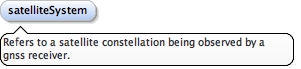
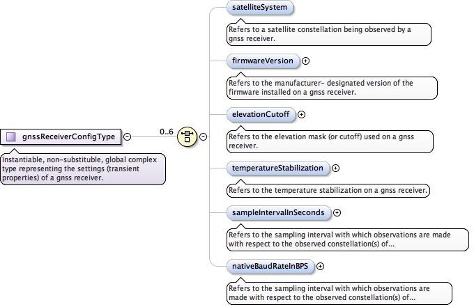
Refers to a satelliteconstellation being observed by a gnss receiver.
Diagram
Type
CodeListType
Properties
content
simple
minOccurs
0
Source
<element minOccurs="0" name="satelliteSystem" type="gml:CodeListType"><annotation><documentation>Refers to a satellite constellation being observed by a gnss receiver.</documentation></annotation></element>
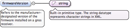
Refers to the manufacturer-designated version of the firmware installedon a gnss receiver.
Diagram
Type
string
Properties
content
simple
minOccurs
0
Source
<element minOccurs="0" name="firmwareVersion" type="string"><annotation><documentation>Refers to the manufacturer- designated version of the firmware installed on a gnss receiver.</documentation></annotation></element>
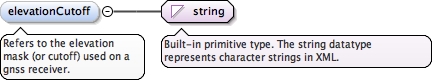
Refers to the elevation mask (or cutoff)used on a gnss receiver.
Diagram
Type
string
Properties
content
simple
minOccurs
0
Source
<element minOccurs="0" name="elevationCutoff" type="string"><annotation><documentation>Refers to the elevation mask (or cutoff) used on a gnss receiver.</documentation></annotation></element>
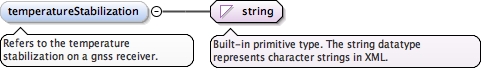
Refers to the temperature stabilizationon a gnss receiver.
Diagram
Type
string
Properties
content
simple
minOccurs
0
Source
<element minOccurs="0" name="temperatureStabilization" type="string"><annotation><documentation>Refers to the temperature stabilization on a gnss receiver.</documentation></annotation></element>
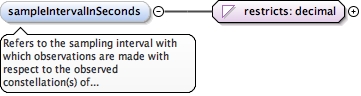
Refers to the sampling interval with whichobservations are made with respect to the observedconstellation(s) of satellite(s).
Diagram
Type
restriction of decimal
Properties
content
simple
minOccurs
0
Facets
totalDigits
4
fractionDigits
1
Source
<element minOccurs="0" name="sampleIntervalInSeconds"><annotation><documentation>Refers to the sampling interval with which observations are made with respect to the observed constellation(s) of satellite(s).</documentation></annotation><simpleType><restriction base="decimal"><totalDigits value="4"/><fractionDigits value="1"/></restriction></simpleType></element>
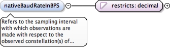
Refers to the sampling interval with whichobservations are made with respect to the observedconstellation(s) of satellite(s).
Diagram
Type
restriction of decimal
Properties
content
simple
minOccurs
0
Facets
totalDigits
6
fractionDigits
0
Source
<element minOccurs="0" name="nativeBaudRateInBPS"><annotation><documentation>Refers to the sampling interval with which observations are made with respect to the observed constellation(s) of satellite(s).</documentation></annotation><simpleType><restriction base="decimal"><totalDigits value="6"/><fractionDigits value="0"/></restriction></simpleType></element>
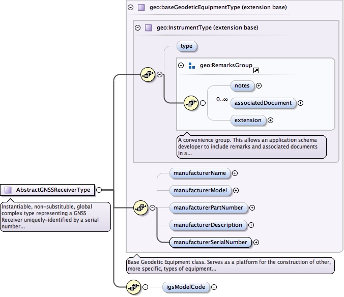
Instantiable, non-substituble, global complex type
                representing a GNSS Receiver uniquely-identified
                by a serial number and IGS model code.

                GeodesyML 0.2 changes: removed  block="#all"
<complexType abstract="true" name="AbstractGNSSReceiverType"><annotation><documentation xml:lang="en">Instantiable, non-substituble, global complex type representing a GNSS Receiver uniquely-identified by a serial number and IGS model code. GeodesyML 0.2 changes: removed block="#all"</documentation></annotation><complexContent><extension base="geo:baseGeodeticEquipmentType"><sequence><element minOccurs="0" name="igsModelCode" type="geo:igsReceiverModelCodeType"/></sequence></extension></complexContent></complexType>
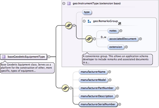
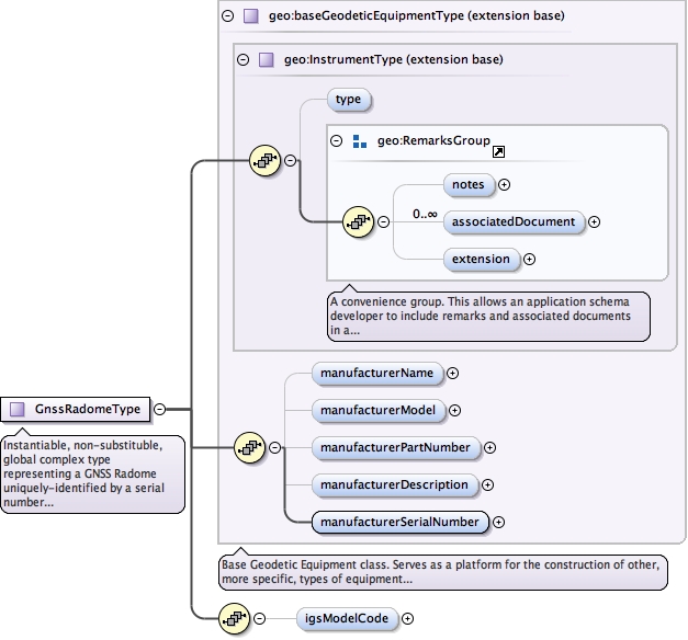
Base Geodetic Equipment class.  Serves as a platform
         for the construction of other, more specific, types
         of equipment related to the field of geodesy.  More
         specifically, this class is designed for equipment
         that can be uniquely-identified.  In other words,
         actual physical objects used in geodetic practices.

         GeodesyML 0.2 change: Extend geo:InstrumentType and removed attr  final="restriction"
<complexType abstract="true" name="baseGeodeticEquipmentType"><annotation><documentation>Base Geodetic Equipment class. Serves as a platform for the construction of other, more specific, types of equipment related to the field of geodesy. More specifically, this class is designed for equipment that can be uniquely-identified. In other words, actual physical objects used in geodetic practices. GeodesyML 0.2 change: Extend geo:InstrumentType and removed attr final="restriction"</documentation></annotation><complexContent><extension base="geo:InstrumentType"><sequence><!-- --><!-- Manufacturer Name --><!-- --><element minOccurs="0" name="manufacturerName" type="string"/><!-- --><!-- Manufacturer Model --><!-- --><element minOccurs="0" name="manufacturerModel" type="string"/><!-- --><!-- Manufacturer Part Number --><!-- --><element minOccurs="0" name="manufacturerPartNumber" type="string"/><!-- --><!-- Manufacturer Description --><!-- --><element minOccurs="0" name="manufacturerDescription" type="string"/><!-- --><!-- Manufacturer Serial Number --><!-- --><element name="manufacturerSerialNumber" type="string"/></sequence></extension></complexContent></complexType>
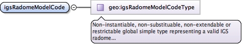
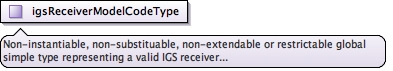
Non-instantiable, non-substituable, non-extendable orrestrictable global simple type representing a validIGS receiver model code. With a codeList attributeto set the allowed types.
<complexType final="#all" name="igsReceiverModelCodeType"><annotation><documentation xml:lang="en">Non-instantiable, non-substituable, non-extendable or restrictable global simple type representing a valid IGS receiver model code. With a codeList attribute to set the allowed types.</documentation></annotation><complexContent><extension base="gco:CodeListValue_Type"/></complexContent></complexType>
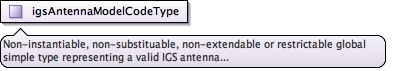
Instantiable, non-substituble, global complex type
        representing a GNSS Antenna uniquely-identified
        by a serial number and IGS model code.

        GeodesyML 0.2: removed block="#all" attribute.
<complexType abstract="true" name="AbstractGNSSAntennaType"><annotation><documentation xml:lang="en">Instantiable, non-substituble, global complex type representing a GNSS Antenna uniquely-identified by a serial number and IGS model code. GeodesyML 0.2: removed block="#all" attribute.</documentation></annotation><complexContent><extension base="geo:baseGeodeticEquipmentType"><sequence><element minOccurs="0" name="igsModelCode" type="geo:igsAntennaModelCodeType"/></sequence></extension></complexContent></complexType>
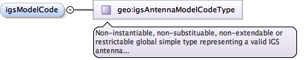
<complexType final="#all" name="igsAntennaModelCodeType"><annotation><documentation xml:lang="en">Non-instantiable, non-substituable, non-extendable or restrictable global simple type representing a valid IGS antenna model code.</documentation></annotation><complexContent><extension base="gco:CodeListValue_Type"/></complexContent></complexType>
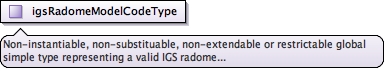
<complexType final="#all" name="igsRadomeModelCodeType"><annotation><documentation xml:lang="en">Non-instantiable, non-substituable, non-extendable or restrictable global simple type representing a valid IGS radome model code.</documentation></annotation><complexContent><extension base="gml:CodeWithAuthorityType"/></complexContent></complexType>
<complexType block="#all" name="GnssRadomeType"><annotation><documentation xml:lang="en">Instantiable, non-substituble, global complex type representing a GNSS Radome uniquely-identified by a serial number and IGS model code.</documentation></annotation><complexContent><extension base="geo:baseGeodeticEquipmentType"><sequence><element minOccurs="0" name="igsModelCode" type="geo:igsRadomeModelCodeType"/></sequence></extension></complexContent></complexType>
<complexType abstract="false" block="#all" name="gnssAntennaConfigType"><annotation><documentation xml:lang="en">Instantiable, non-substituble, global complex type representing the settings (transient properties) of a gnss antenna.</documentation></annotation><choice maxOccurs="2" minOccurs="0"><element minOccurs="0" name="antennaCableLengthMeters"><annotation><documentation>Refers to the length (in meters) of the cable used to connect the antenna to other gnss equipment (typically a gnss receiver or set of receivers).</documentation></annotation><simpleType><restriction base="decimal"><totalDigits value="6"/><fractionDigits value="3"/></restriction></simpleType></element><element minOccurs="0" name="antennaCableType" type="string"><annotation><documentation>Refers to the type of cable used to connect the antenna to other gnss equipment (typically a gnss receiver or set of receivers).</documentation></annotation></element></choice></complexType>
Instantiable, non-substituble, global complex typerepresenting the measurement of a distance betweena specified location on a gnss antenna and anotherlocation of choice.
<complexType abstract="false" block="#all" name="gnssAntennaHeightMeasurementType"><annotation><documentation xml:lang="en">Instantiable, non-substituble, global complex type representing the measurement of a distance between a specified location on a gnss antenna and another location of choice.</documentation></annotation><choice maxOccurs="5"><element default="vertical" minOccurs="0" name="type" type="gml:CodeWithAuthorityType"/><element name="value"><annotation><documentation>Refers to the distance (+|-) between the geodetic reference point of the associated monument, and a chosen reference point on the antenna.</documentation></annotation><simpleType><restriction base="decimal"><totalDigits value="6"/><fractionDigits value="4"/></restriction></simpleType></element><element minOccurs="0" ref="gml:unitOfMeasure"/><element default="BPA" minOccurs="0" name="referencePoint" type="gml:CodeWithAuthorityType"/><element minOccurs="0" name="dateAndTimeUTC" type="gml:TimePositionType"/></choice></complexType>
<complexType abstract="false" block="#all" name="gnssRadomeConfigType"><annotation><documentation xml:lang="en">Instantiable, non-substituble, global complex type representing the settings (transient properties) of a gnss radome.</documentation></annotation><choice minOccurs="0"><element minOccurs="0" name="radomeFastenerType" type="string"><annotation><documentation>Refers to the type of fasteners used to secure a radome in place. This is pretty much a bogus data field intended for future compatibility purposes.</documentation></annotation></element></choice></complexType>
<complexType abstract="false" block="#all" name="gnssReceiverConfigType"><annotation><documentation xml:lang="en">Instantiable, non-substituble, global complex type representing the settings (transient properties) of a gnss receiver.</documentation></annotation><choice maxOccurs="6" minOccurs="0"><element minOccurs="0" name="satelliteSystem" type="gml:CodeListType"><annotation><documentation>Refers to a satellite constellation being observed by a gnss receiver.</documentation></annotation></element><element minOccurs="0" name="firmwareVersion" type="string"><annotation><documentation>Refers to the manufacturer- designated version of the firmware installed on a gnss receiver.</documentation></annotation></element><element minOccurs="0" name="elevationCutoff" type="string"><annotation><documentation>Refers to the elevation mask (or cutoff) used on a gnss receiver.</documentation></annotation></element><element minOccurs="0" name="temperatureStabilization" type="string"><annotation><documentation>Refers to the temperature stabilization on a gnss receiver.</documentation></annotation></element><element minOccurs="0" name="sampleIntervalInSeconds"><annotation><documentation>Refers to the sampling interval with which observations are made with respect to the observed constellation(s) of satellite(s).</documentation></annotation><simpleType><restriction base="decimal"><totalDigits value="4"/><fractionDigits value="1"/></restriction></simpleType></element><element minOccurs="0" name="nativeBaudRateInBPS"><annotation><documentation>Refers to the sampling interval with which observations are made with respect to the observed constellation(s) of satellite(s).</documentation></annotation><simpleType><restriction base="decimal"><totalDigits value="6"/><fractionDigits value="0"/></restriction></simpleType></element></choice></complexType>