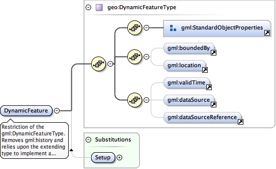
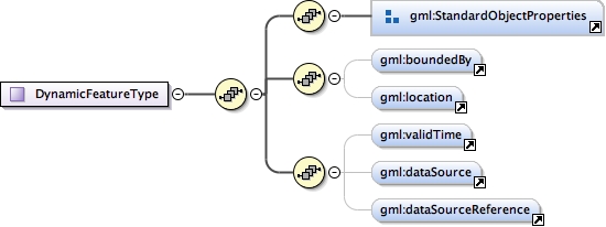
Restriction of the gml:DynamicFeatureType. Removes gml:history and relies upon the extending type to implement a history element that restricts child types to those allowed by the class model.
<element abstract="true" name="DynamicFeature" substitutionGroup="gml:AbstractFeature" type="geo:DynamicFeatureType"><annotation><documentation>Restriction of the gml:DynamicFeatureType. Removes gml:history and relies upon the extending type to implement a history element that restricts child types to those allowed by the class model.</documentation></annotation></element>
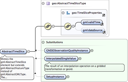
Mimics the gml:AbstractTimeSlice element but extends gml:AbstractFeatureType instead of gml:AbstractGMLType. The purpose of making this distinction is to ensure better access to a wider variety of WFS solutions that use the gml:AbstractFeature/gml:Location element for visualisation.
<element abstract="true" name="AbstractTimeSlice" substitutionGroup="gml:AbstractFeature" type="geo:AbstractTimeSliceType"><annotation><documentation>Mimics the gml:AbstractTimeSlice element but extends gml:AbstractFeatureType instead of gml:AbstractGMLType. The purpose of making this distinction is to ensure better access to a wider variety of WFS solutions that use the gml:AbstractFeature/gml:Location element for visualisation.</documentation></annotation></element>
<complexType final="#all" name="countryCodeType"><annotation><documentation xml:lang="en">Three-letter country code (ISO ISO 3166-1 alpha-3, https://en.wikipedia.org/wiki/ISO_3166-1_alpha-3)</documentation></annotation><complexContent><extension base="gco:CodeListValue_Type"/></complexContent></complexType>
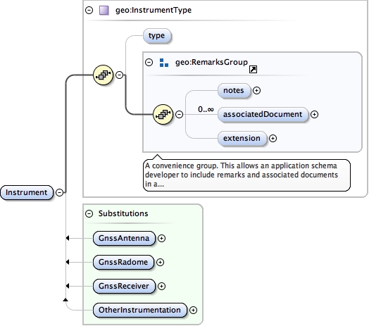
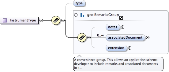
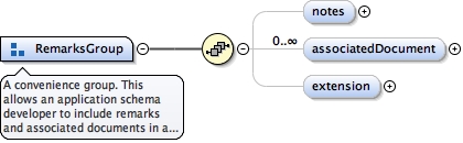
<group name="RemarksGroup"><annotation><documentation>A convenience group. This allows an application schema developer to include remarks and associated documents in a standard fashion.</documentation></annotation><sequence><element minOccurs="0" name="notes" type="string"/><element maxOccurs="unbounded" minOccurs="0" name="associatedDocument" type="geo:DocumentPropertyType"/><element minOccurs="0" name="extension" type="anyType"/></sequence></group>
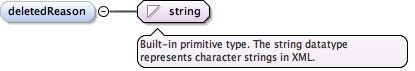
<group name="ChangeTracking"><annotation><documentation>A convenience group to log changes made to each meta-data block.</documentation></annotation><sequence><sequence><element name="dateInserted" type="gml:TimePositionType"/><element minOccurs="0" name="dateDeleted" type="gml:TimePositionType"/><element minOccurs="0" name="deletedReason" type="string"/></sequence></sequence></group>
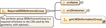
The attribute group SRSReferenceGroup is a required reference to the CRS used by this geometry, with optional additional information to simplify the processing of the coordinates when a more complete definition of the CRS is not needed.In general the attribute srsName points to a CRS instance of gml:AbstractCoordinateReferenceSystem. For well-known references it is not required that the CRS description exists at the location the URI points to. If no srsName attribute is given, the CRS shall be specified as part of the larger context this geometry element is part of.
<attributeGroup name="RequiredSRSReferenceGroup"><annotation><documentation>The attribute group SRSReferenceGroup is a required reference to the CRS used by this geometry, with optional additional information to simplify the processing of the coordinates when a more complete definition of the CRS is not needed. In general the attribute srsName points to a CRS instance of gml:AbstractCoordinateReferenceSystem. For well-known references it is not required that the CRS description exists at the location the URI points to. If no srsName attribute is given, the CRS shall be specified as part of the larger context this geometry element is part of.</documentation></annotation><attribute name="srsName" type="anyURI" use="required"/><attribute name="srsDimension" type="positiveInteger"/><attributeGroup ref="gml:SRSInformationGroup"/></attributeGroup>