Included schema measurement.xsd
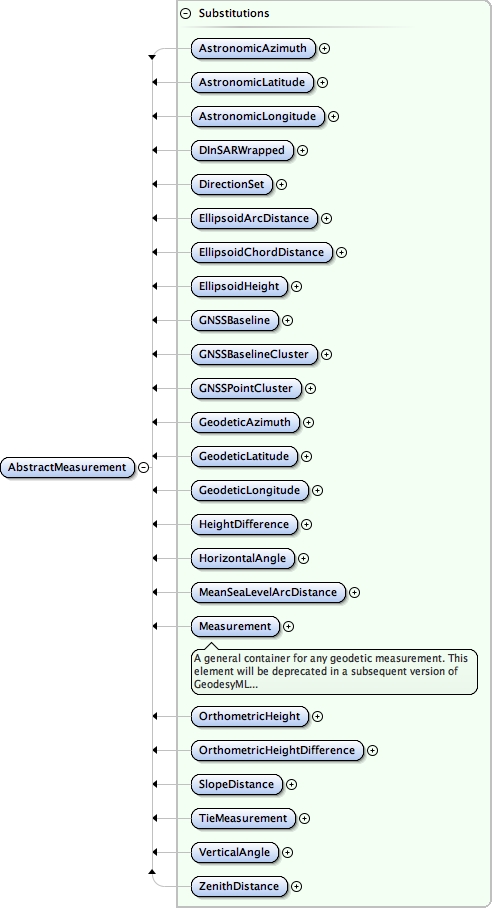
Element geo:AbstractMeasurement
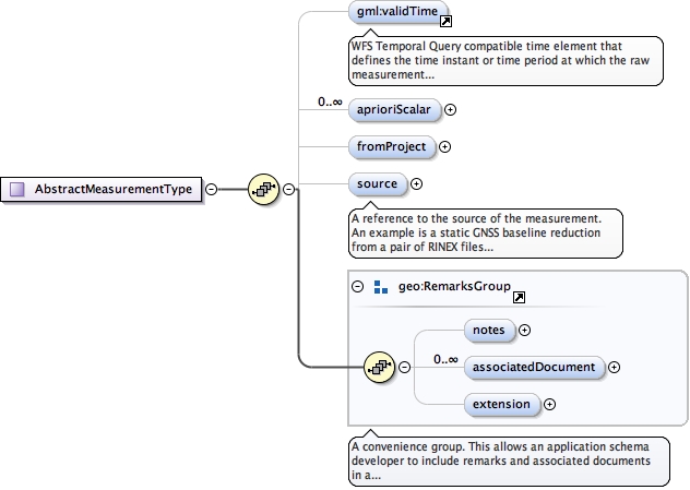
Element geo:Measurement
Namespace urn:xml-gov-au:icsm:egeodesy:0.4
Annotations
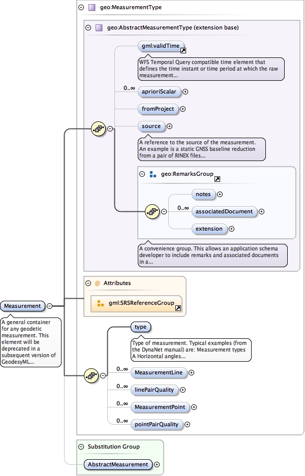
A general container for any geodetic measurement. This element will be deprecated in a subsequent version of GeodesyML subject to the requirements coverage provided by the specific named measurement types such as GNSSBaseline, DirectionSet, OrthometricHeight, etc.
Diagram
Type geo:MeasurementType
Type hierarchy
Properties
Substitution Group Affiliation
Model
validTime{0,1} ,
geo:aprioriScalar* ,
geo:fromProject{0,1} ,
geo:source{0,1} ,
geo:notes{0,1} ,
geo:associatedDocument* ,
geo:extension{0,1} ,
geo:type ,
geo:MeasurementLine* ,
geo:linePairQuality* ,
geo:MeasurementPoint* ,
geo:pointPairQuality*
Children geo:MeasurementLine geo:MeasurementPoint geo:aprioriScalar geo:associatedDocument geo:extension geo:fromProject geo:linePairQuality geo:notes geo:pointPairQuality geo:source geo:type validTime
Instance
<geo:Measurement xmlns:geo= "urn:xml-gov-au:icsm:egeodesy:0.4" >
<validTime > {0,1} </validTime>
<geo:aprioriScalar axisLabels= "" codeSpace= "" confidence= "" uomLabels= "" > {0,unbounded} </geo:aprioriScalar>
<geo:fromProject > {0,1} </geo:fromProject>
<geo:source > {0,1} </geo:source>
<geo:notes > {0,1} </geo:notes>
<geo:associatedDocument > {0,unbounded} </geo:associatedDocument>
<geo:extension > {0,1} </geo:extension>
<geo:type > {1,1} </geo:type>
<geo:MeasurementLine > {0,unbounded} </geo:MeasurementLine>
<geo:linePairQuality > {0,unbounded} </geo:linePairQuality>
<geo:MeasurementPoint > {0,unbounded} </geo:MeasurementPoint>
<geo:pointPairQuality > {0,unbounded} </geo:pointPairQuality>
</geo:Measurement>
Source
<element name= "Measurement" substitutionGroup= "geo:AbstractMeasurement" type= "geo:MeasurementType" >
<annotation >
<documentation > A general container for any geodetic measurement. This element will be deprecated in a subsequent version of GeodesyML subject to the requirements coverage provided by the specific named measurement types such as GNSSBaseline, DirectionSet, OrthometricHeight, etc. </documentation>
</annotation>
</element>
Schema location file:/Users/boss/dev/GeodesyML/schemas/measurement.xsd
Namespace urn:xml-gov-au:icsm:egeodesy:0.4
Diagram
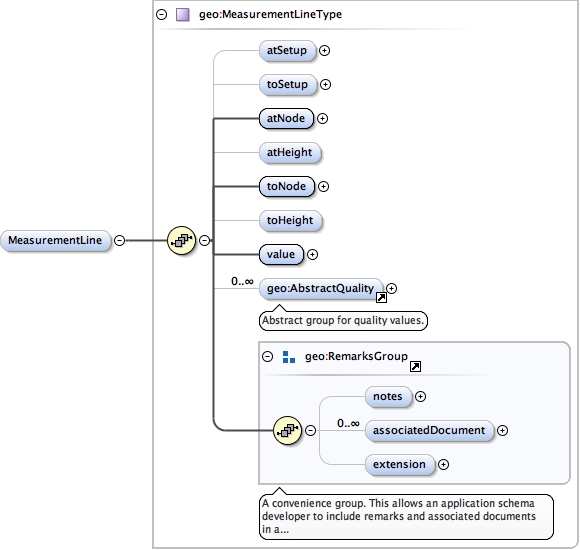
Type geo:MeasurementLineType
Type hierarchy
Properties
content
complex
minOccurs
0
maxOccurs
unbounded
Model
geo:atSetup{0,1} ,
geo:toSetup{0,1} ,
geo:atNode ,
geo:atHeight{0,1} ,
geo:toNode ,
geo:toHeight{0,1} ,
geo:value ,
geo:AbstractQuality* ,
geo:notes{0,1} ,
geo:associatedDocument* ,
geo:extension{0,1}
Children geo:AbstractQuality geo:associatedDocument geo:atHeight geo:atNode geo:atSetup geo:extension geo:notes geo:toHeight geo:toNode geo:toSetup geo:value
Instance
<geo:MeasurementLine xmlns:geo= "urn:xml-gov-au:icsm:egeodesy:0.4" >
<geo:atSetup > {0,1} </geo:atSetup>
<geo:toSetup > {0,1} </geo:toSetup>
<geo:atNode > {1,1} </geo:atNode>
<geo:atHeight > {0,1} </geo:atHeight>
<geo:toNode > {1,1} </geo:toNode>
<geo:toHeight > {0,1} </geo:toHeight>
<geo:value > {1,1} </geo:value>
<geo:AbstractQuality > {0,unbounded} </geo:AbstractQuality>
<geo:notes > {0,1} </geo:notes>
<geo:associatedDocument > {0,unbounded} </geo:associatedDocument>
<geo:extension > {0,1} </geo:extension>
</geo:MeasurementLine>
Source
<element maxOccurs= "unbounded" minOccurs= "0" name= "MeasurementLine" type= "geo:MeasurementLineType" />
Schema location file:/Users/boss/dev/GeodesyML/schemas/measurement.xsd
Namespace urn:xml-gov-au:icsm:egeodesy:0.4
Diagram
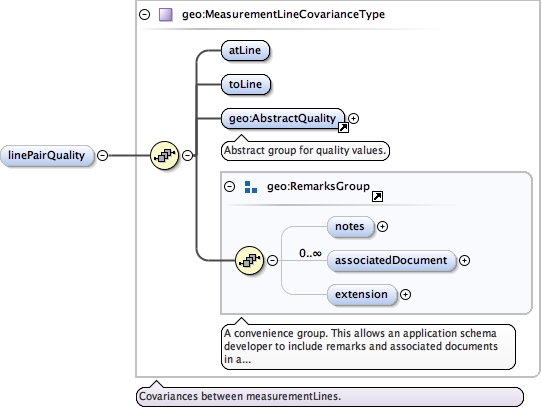
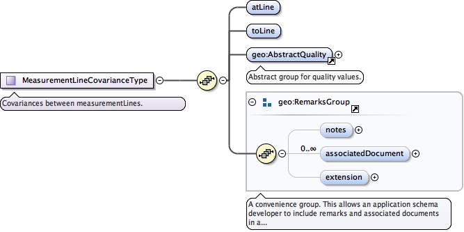
Type geo:MeasurementLineCovarianceType
Type hierarchy
Properties
content
complex
minOccurs
0
maxOccurs
unbounded
Model
Children geo:AbstractQuality geo:associatedDocument geo:atLine geo:extension geo:notes geo:toLine
Instance
<geo:linePairQuality xmlns:geo= "urn:xml-gov-au:icsm:egeodesy:0.4" >
<geo:atLine > {1,1} </geo:atLine>
<geo:toLine > {1,1} </geo:toLine>
<geo:AbstractQuality > {1,1} </geo:AbstractQuality>
<geo:notes > {0,1} </geo:notes>
<geo:associatedDocument > {0,unbounded} </geo:associatedDocument>
<geo:extension > {0,1} </geo:extension>
</geo:linePairQuality>
Source
<element maxOccurs= "unbounded" minOccurs= "0" name= "linePairQuality" type= "geo:MeasurementLineCovarianceType" />
Schema location file:/Users/boss/dev/GeodesyML/schemas/measurement.xsd
Namespace urn:xml-gov-au:icsm:egeodesy:0.4
Diagram
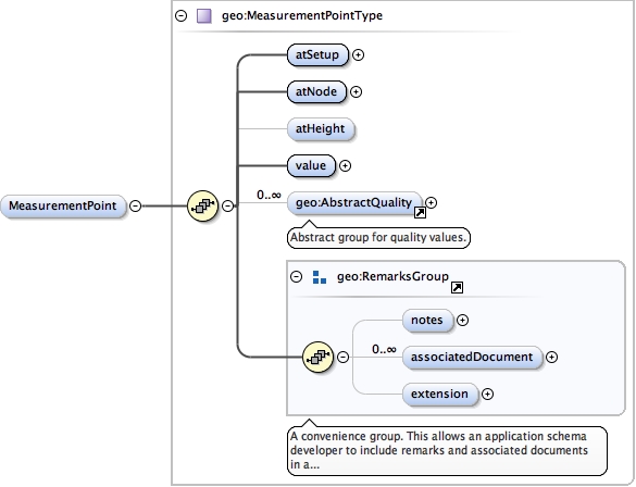
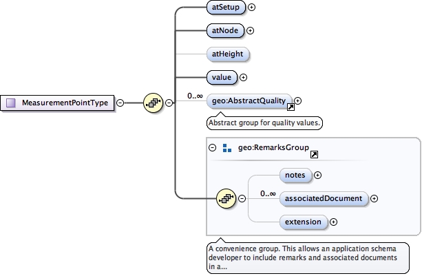
Type geo:MeasurementPointType
Type hierarchy
Properties
content
complex
minOccurs
0
maxOccurs
unbounded
Model
geo:atSetup ,
geo:atNode ,
geo:atHeight{0,1} ,
geo:value ,
geo:AbstractQuality* ,
geo:notes{0,1} ,
geo:associatedDocument* ,
geo:extension{0,1}
Children geo:AbstractQuality geo:associatedDocument geo:atHeight geo:atNode geo:atSetup geo:extension geo:notes geo:value
Instance
<geo:MeasurementPoint xmlns:geo= "urn:xml-gov-au:icsm:egeodesy:0.4" >
<geo:atSetup > {1,1} </geo:atSetup>
<geo:atNode > {1,1} </geo:atNode>
<geo:atHeight > {0,1} </geo:atHeight>
<geo:value uomLabel= "" > {1,1} </geo:value>
<geo:AbstractQuality > {0,unbounded} </geo:AbstractQuality>
<geo:notes > {0,1} </geo:notes>
<geo:associatedDocument > {0,unbounded} </geo:associatedDocument>
<geo:extension > {0,1} </geo:extension>
</geo:MeasurementPoint>
Source
<element maxOccurs= "unbounded" minOccurs= "0" name= "MeasurementPoint" type= "geo:MeasurementPointType" />
Schema location file:/Users/boss/dev/GeodesyML/schemas/measurement.xsd
Namespace urn:xml-gov-au:icsm:egeodesy:0.4
Diagram
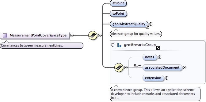
Type geo:MeasurementPointCovarianceType
Type hierarchy
Properties
content
complex
minOccurs
0
maxOccurs
unbounded
Model
Children geo:AbstractQuality geo:associatedDocument geo:atPoint geo:extension geo:notes geo:toPoint
Instance
<geo:pointPairQuality xmlns:geo= "urn:xml-gov-au:icsm:egeodesy:0.4" >
<geo:atPoint > {1,1} </geo:atPoint>
<geo:toPoint > {1,1} </geo:toPoint>
<geo:AbstractQuality > {1,1} </geo:AbstractQuality>
<geo:notes > {0,1} </geo:notes>
<geo:associatedDocument > {0,unbounded} </geo:associatedDocument>
<geo:extension > {0,1} </geo:extension>
</geo:pointPairQuality>
Source
<element maxOccurs= "unbounded" minOccurs= "0" name= "pointPairQuality" type= "geo:MeasurementPointCovarianceType" />
Schema location file:/Users/boss/dev/GeodesyML/schemas/measurement.xsd
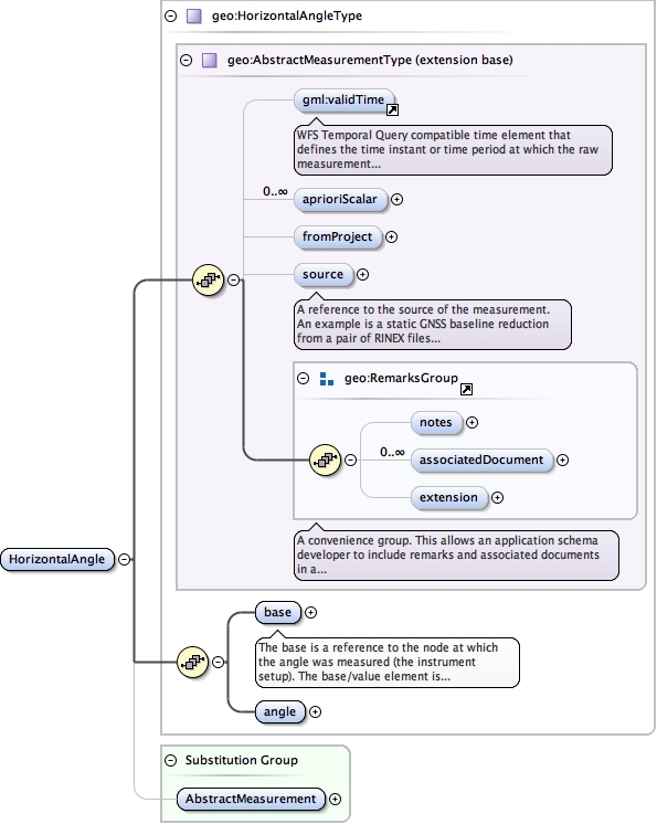
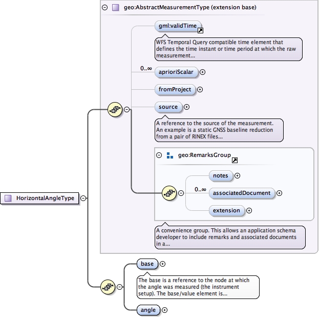
Element geo:HorizontalAngle
Namespace urn:xml-gov-au:icsm:egeodesy:0.4
Diagram
Type geo:HorizontalAngleType
Type hierarchy
Properties
Substitution Group Affiliation
Model
validTime{0,1} ,
geo:aprioriScalar* ,
geo:fromProject{0,1} ,
geo:source{0,1} ,
geo:notes{0,1} ,
geo:associatedDocument* ,
geo:extension{0,1} ,
geo:base ,
geo:angle
Children geo:angle geo:aprioriScalar geo:associatedDocument geo:base geo:extension geo:fromProject geo:notes geo:source validTime
Instance
<geo:HorizontalAngle xmlns:geo= "urn:xml-gov-au:icsm:egeodesy:0.4" >
<validTime > {0,1} </validTime>
<geo:aprioriScalar axisLabels= "" codeSpace= "" confidence= "" uomLabels= "" > {0,unbounded} </geo:aprioriScalar>
<geo:fromProject > {0,1} </geo:fromProject>
<geo:source > {0,1} </geo:source>
<geo:notes > {0,1} </geo:notes>
<geo:associatedDocument > {0,unbounded} </geo:associatedDocument>
<geo:extension > {0,1} </geo:extension>
<geo:base > {1,1} </geo:base>
<geo:angle > {1,1} </geo:angle>
</geo:HorizontalAngle>
Source
<element name= "HorizontalAngle" substitutionGroup= "geo:AbstractMeasurement" type= "geo:HorizontalAngleType" />
Schema location file:/Users/boss/dev/GeodesyML/schemas/measurement.xsd
Namespace urn:xml-gov-au:icsm:egeodesy:0.4
Annotations
The base is a reference to the node at which the angle was measured (the instrument setup). The base/value element is ignored and by convention should be blank.
Diagram
Type geo:MeasurementPointType
Type hierarchy
Properties
Model
geo:atSetup ,
geo:atNode ,
geo:atHeight{0,1} ,
geo:value ,
geo:AbstractQuality* ,
geo:notes{0,1} ,
geo:associatedDocument* ,
geo:extension{0,1}
Children geo:AbstractQuality geo:associatedDocument geo:atHeight geo:atNode geo:atSetup geo:extension geo:notes geo:value
Instance
<geo:base xmlns:geo= "urn:xml-gov-au:icsm:egeodesy:0.4" >
<geo:atSetup > {1,1} </geo:atSetup>
<geo:atNode > {1,1} </geo:atNode>
<geo:atHeight > {0,1} </geo:atHeight>
<geo:value uomLabel= "" > {1,1} </geo:value>
<geo:AbstractQuality > {0,unbounded} </geo:AbstractQuality>
<geo:notes > {0,1} </geo:notes>
<geo:associatedDocument > {0,unbounded} </geo:associatedDocument>
<geo:extension > {0,1} </geo:extension>
</geo:base>
Source
<element name= "base" type= "geo:MeasurementPointType" >
<annotation >
<documentation > The base is a reference to the node at which the angle was measured (the instrument setup). The base/value element is ignored and by convention should be blank. </documentation>
</annotation>
</element>
Schema location file:/Users/boss/dev/GeodesyML/schemas/measurement.xsd
Namespace urn:xml-gov-au:icsm:egeodesy:0.4
Diagram
Type geo:MeasurementLineType
Type hierarchy
Properties
Model
geo:atSetup{0,1} ,
geo:toSetup{0,1} ,
geo:atNode ,
geo:atHeight{0,1} ,
geo:toNode ,
geo:toHeight{0,1} ,
geo:value ,
geo:AbstractQuality* ,
geo:notes{0,1} ,
geo:associatedDocument* ,
geo:extension{0,1}
Children geo:AbstractQuality geo:associatedDocument geo:atHeight geo:atNode geo:atSetup geo:extension geo:notes geo:toHeight geo:toNode geo:toSetup geo:value
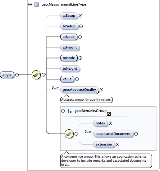
Instance
<geo:angle xmlns:geo= "urn:xml-gov-au:icsm:egeodesy:0.4" >
<geo:atSetup > {0,1} </geo:atSetup>
<geo:toSetup > {0,1} </geo:toSetup>
<geo:atNode > {1,1} </geo:atNode>
<geo:atHeight > {0,1} </geo:atHeight>
<geo:toNode > {1,1} </geo:toNode>
<geo:toHeight > {0,1} </geo:toHeight>
<geo:value > {1,1} </geo:value>
<geo:AbstractQuality > {0,unbounded} </geo:AbstractQuality>
<geo:notes > {0,1} </geo:notes>
<geo:associatedDocument > {0,unbounded} </geo:associatedDocument>
<geo:extension > {0,1} </geo:extension>
</geo:angle>
Source
<element name= "angle" type= "geo:MeasurementLineType" />
Schema location file:/Users/boss/dev/GeodesyML/schemas/measurement.xsd
Element geo:GeodeticAzimuth
Namespace urn:xml-gov-au:icsm:egeodesy:0.4
Diagram
Type geo:GeodeticAzimuthType
Type hierarchy
Properties
Substitution Group Affiliation
Model
validTime{0,1} ,
geo:aprioriScalar* ,
geo:fromProject{0,1} ,
geo:source{0,1} ,
geo:notes{0,1} ,
geo:associatedDocument* ,
geo:extension{0,1} ,
geo:azimuth
Children geo:aprioriScalar geo:associatedDocument geo:azimuth geo:extension geo:fromProject geo:notes geo:source validTime
Instance
<geo:GeodeticAzimuth srsDimension= "" srsName= "" xmlns:geo= "urn:xml-gov-au:icsm:egeodesy:0.4" >
<validTime > {0,1} </validTime>
<geo:aprioriScalar axisLabels= "" codeSpace= "" confidence= "" uomLabels= "" > {0,unbounded} </geo:aprioriScalar>
<geo:fromProject > {0,1} </geo:fromProject>
<geo:source > {0,1} </geo:source>
<geo:notes > {0,1} </geo:notes>
<geo:associatedDocument > {0,unbounded} </geo:associatedDocument>
<geo:extension > {0,1} </geo:extension>
<geo:azimuth > {1,1} </geo:azimuth>
</geo:GeodeticAzimuth>
Attributes
Source
<element name= "GeodeticAzimuth" substitutionGroup= "geo:AbstractMeasurement" type= "geo:GeodeticAzimuthType" />
Schema location file:/Users/boss/dev/GeodesyML/schemas/measurement.xsd
Namespace urn:xml-gov-au:icsm:egeodesy:0.4
Diagram
Type geo:MeasurementLineType
Type hierarchy
Properties
Model
geo:atSetup{0,1} ,
geo:toSetup{0,1} ,
geo:atNode ,
geo:atHeight{0,1} ,
geo:toNode ,
geo:toHeight{0,1} ,
geo:value ,
geo:AbstractQuality* ,
geo:notes{0,1} ,
geo:associatedDocument* ,
geo:extension{0,1}
Children geo:AbstractQuality geo:associatedDocument geo:atHeight geo:atNode geo:atSetup geo:extension geo:notes geo:toHeight geo:toNode geo:toSetup geo:value
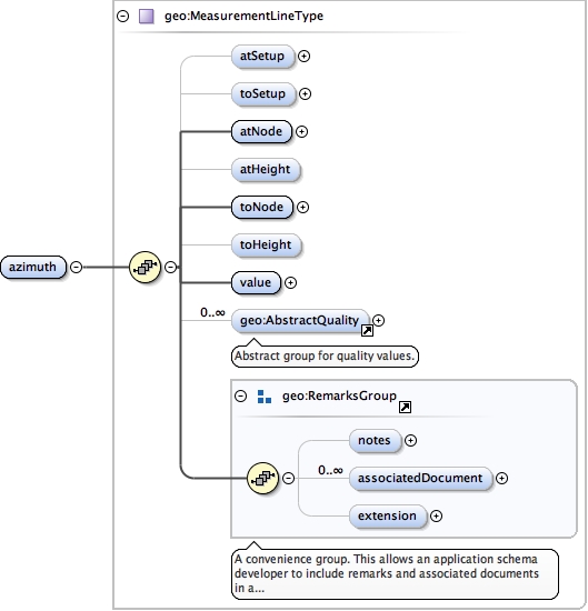
Instance
<geo:azimuth xmlns:geo= "urn:xml-gov-au:icsm:egeodesy:0.4" >
<geo:atSetup > {0,1} </geo:atSetup>
<geo:toSetup > {0,1} </geo:toSetup>
<geo:atNode > {1,1} </geo:atNode>
<geo:atHeight > {0,1} </geo:atHeight>
<geo:toNode > {1,1} </geo:toNode>
<geo:toHeight > {0,1} </geo:toHeight>
<geo:value > {1,1} </geo:value>
<geo:AbstractQuality > {0,unbounded} </geo:AbstractQuality>
<geo:notes > {0,1} </geo:notes>
<geo:associatedDocument > {0,unbounded} </geo:associatedDocument>
<geo:extension > {0,1} </geo:extension>
</geo:azimuth>
Source
<element name= "azimuth" type= "geo:MeasurementLineType" />
Schema location file:/Users/boss/dev/GeodesyML/schemas/measurement.xsd
Element geo:EllipsoidChordDistance
Namespace urn:xml-gov-au:icsm:egeodesy:0.4
Diagram
Type geo:EllipsoidChordDistanceType
Type hierarchy
Properties
Substitution Group Affiliation
Model
validTime{0,1} ,
geo:aprioriScalar* ,
geo:fromProject{0,1} ,
geo:source{0,1} ,
geo:notes{0,1} ,
geo:associatedDocument* ,
geo:extension{0,1} ,
geo:distance
Children geo:aprioriScalar geo:associatedDocument geo:distance geo:extension geo:fromProject geo:notes geo:source validTime
Instance
<geo:EllipsoidChordDistance srsDimension= "" srsName= "" xmlns:geo= "urn:xml-gov-au:icsm:egeodesy:0.4" >
<validTime > {0,1} </validTime>
<geo:aprioriScalar axisLabels= "" codeSpace= "" confidence= "" uomLabels= "" > {0,unbounded} </geo:aprioriScalar>
<geo:fromProject > {0,1} </geo:fromProject>
<geo:source > {0,1} </geo:source>
<geo:notes > {0,1} </geo:notes>
<geo:associatedDocument > {0,unbounded} </geo:associatedDocument>
<geo:extension > {0,1} </geo:extension>
<geo:distance > {1,1} </geo:distance>
</geo:EllipsoidChordDistance>
Attributes
Source
<element name= "EllipsoidChordDistance" substitutionGroup= "geo:AbstractMeasurement" type= "geo:EllipsoidChordDistanceType" />
Schema location file:/Users/boss/dev/GeodesyML/schemas/measurement.xsd
Namespace urn:xml-gov-au:icsm:egeodesy:0.4
Diagram
Type geo:MeasurementLineType
Type hierarchy
Properties
Model
geo:atSetup{0,1} ,
geo:toSetup{0,1} ,
geo:atNode ,
geo:atHeight{0,1} ,
geo:toNode ,
geo:toHeight{0,1} ,
geo:value ,
geo:AbstractQuality* ,
geo:notes{0,1} ,
geo:associatedDocument* ,
geo:extension{0,1}
Children geo:AbstractQuality geo:associatedDocument geo:atHeight geo:atNode geo:atSetup geo:extension geo:notes geo:toHeight geo:toNode geo:toSetup geo:value
Instance
<geo:distance xmlns:geo= "urn:xml-gov-au:icsm:egeodesy:0.4" >
<geo:atSetup > {0,1} </geo:atSetup>
<geo:toSetup > {0,1} </geo:toSetup>
<geo:atNode > {1,1} </geo:atNode>
<geo:atHeight > {0,1} </geo:atHeight>
<geo:toNode > {1,1} </geo:toNode>
<geo:toHeight > {0,1} </geo:toHeight>
<geo:value > {1,1} </geo:value>
<geo:AbstractQuality > {0,unbounded} </geo:AbstractQuality>
<geo:notes > {0,1} </geo:notes>
<geo:associatedDocument > {0,unbounded} </geo:associatedDocument>
<geo:extension > {0,1} </geo:extension>
</geo:distance>
Source
<element name= "distance" type= "geo:MeasurementLineType" />
Schema location file:/Users/boss/dev/GeodesyML/schemas/measurement.xsd
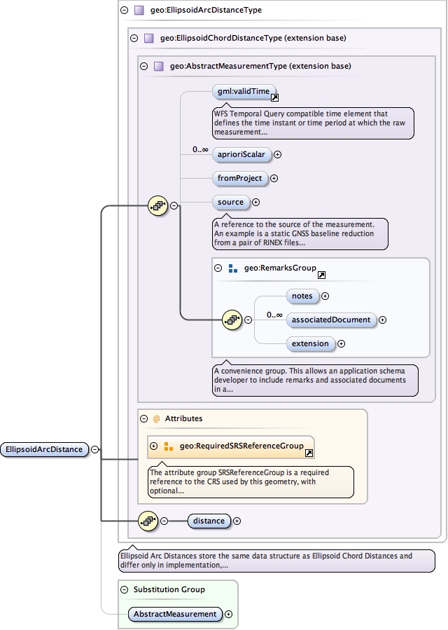
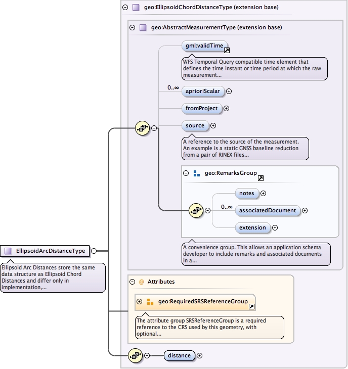
Element geo:EllipsoidArcDistance
Namespace urn:xml-gov-au:icsm:egeodesy:0.4
Diagram
Type geo:EllipsoidArcDistanceType
Type hierarchy
Properties
Substitution Group Affiliation
Model
validTime{0,1} ,
geo:aprioriScalar* ,
geo:fromProject{0,1} ,
geo:source{0,1} ,
geo:notes{0,1} ,
geo:associatedDocument* ,
geo:extension{0,1} ,
geo:distance
Children geo:aprioriScalar geo:associatedDocument geo:distance geo:extension geo:fromProject geo:notes geo:source validTime
Instance
<geo:EllipsoidArcDistance srsDimension= "" srsName= "" xmlns:geo= "urn:xml-gov-au:icsm:egeodesy:0.4" >
<validTime > {0,1} </validTime>
<geo:aprioriScalar axisLabels= "" codeSpace= "" confidence= "" uomLabels= "" > {0,unbounded} </geo:aprioriScalar>
<geo:fromProject > {0,1} </geo:fromProject>
<geo:source > {0,1} </geo:source>
<geo:notes > {0,1} </geo:notes>
<geo:associatedDocument > {0,unbounded} </geo:associatedDocument>
<geo:extension > {0,1} </geo:extension>
<geo:distance > {1,1} </geo:distance>
</geo:EllipsoidArcDistance>
Attributes
Source
<element name= "EllipsoidArcDistance" substitutionGroup= "geo:AbstractMeasurement" type= "geo:EllipsoidArcDistanceType" />
Schema location file:/Users/boss/dev/GeodesyML/schemas/measurement.xsd
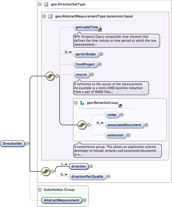
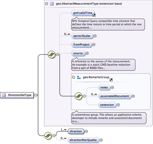
Element geo:DirectionSet
Namespace urn:xml-gov-au:icsm:egeodesy:0.4
Diagram
Type geo:DirectionSetType
Type hierarchy
Properties
Substitution Group Affiliation
Model
validTime{0,1} ,
geo:aprioriScalar* ,
geo:fromProject{0,1} ,
geo:source{0,1} ,
geo:notes{0,1} ,
geo:associatedDocument* ,
geo:extension{0,1} ,
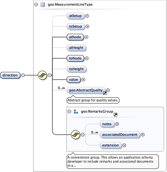
geo:direction+ ,
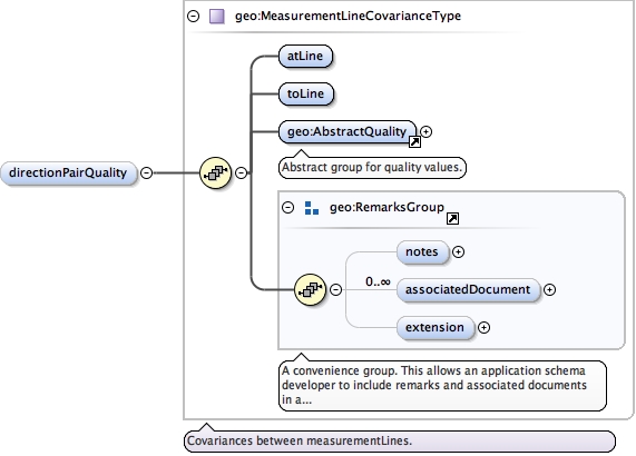
geo:directionPairQuality*
Children geo:aprioriScalar geo:associatedDocument geo:direction geo:directionPairQuality geo:extension geo:fromProject geo:notes geo:source validTime
Instance
<geo:DirectionSet xmlns:geo= "urn:xml-gov-au:icsm:egeodesy:0.4" >
<validTime > {0,1} </validTime>
<geo:aprioriScalar axisLabels= "" codeSpace= "" confidence= "" uomLabels= "" > {0,unbounded} </geo:aprioriScalar>
<geo:fromProject > {0,1} </geo:fromProject>
<geo:source > {0,1} </geo:source>
<geo:notes > {0,1} </geo:notes>
<geo:associatedDocument > {0,unbounded} </geo:associatedDocument>
<geo:extension > {0,1} </geo:extension>
<geo:direction > {1,unbounded} </geo:direction>
<geo:directionPairQuality > {0,unbounded} </geo:directionPairQuality>
</geo:DirectionSet>
Source
<element name= "DirectionSet" substitutionGroup= "geo:AbstractMeasurement" type= "geo:DirectionSetType" />
Schema location file:/Users/boss/dev/GeodesyML/schemas/measurement.xsd
Namespace urn:xml-gov-au:icsm:egeodesy:0.4
Diagram
Type geo:MeasurementLineType
Type hierarchy
Properties
content
complex
maxOccurs
unbounded
Model
geo:atSetup{0,1} ,
geo:toSetup{0,1} ,
geo:atNode ,
geo:atHeight{0,1} ,
geo:toNode ,
geo:toHeight{0,1} ,
geo:value ,
geo:AbstractQuality* ,
geo:notes{0,1} ,
geo:associatedDocument* ,
geo:extension{0,1}
Children geo:AbstractQuality geo:associatedDocument geo:atHeight geo:atNode geo:atSetup geo:extension geo:notes geo:toHeight geo:toNode geo:toSetup geo:value
Instance
<geo:direction xmlns:geo= "urn:xml-gov-au:icsm:egeodesy:0.4" >
<geo:atSetup > {0,1} </geo:atSetup>
<geo:toSetup > {0,1} </geo:toSetup>
<geo:atNode > {1,1} </geo:atNode>
<geo:atHeight > {0,1} </geo:atHeight>
<geo:toNode > {1,1} </geo:toNode>
<geo:toHeight > {0,1} </geo:toHeight>
<geo:value > {1,1} </geo:value>
<geo:AbstractQuality > {0,unbounded} </geo:AbstractQuality>
<geo:notes > {0,1} </geo:notes>
<geo:associatedDocument > {0,unbounded} </geo:associatedDocument>
<geo:extension > {0,1} </geo:extension>
</geo:direction>
Source
<element maxOccurs= "unbounded" name= "direction" type= "geo:MeasurementLineType" />
Schema location file:/Users/boss/dev/GeodesyML/schemas/measurement.xsd
Namespace urn:xml-gov-au:icsm:egeodesy:0.4
Diagram
Type geo:MeasurementLineCovarianceType
Type hierarchy
Properties
content
complex
minOccurs
0
maxOccurs
unbounded
Model
Children geo:AbstractQuality geo:associatedDocument geo:atLine geo:extension geo:notes geo:toLine
Instance
<geo:directionPairQuality xmlns:geo= "urn:xml-gov-au:icsm:egeodesy:0.4" >
<geo:atLine > {1,1} </geo:atLine>
<geo:toLine > {1,1} </geo:toLine>
<geo:AbstractQuality > {1,1} </geo:AbstractQuality>
<geo:notes > {0,1} </geo:notes>
<geo:associatedDocument > {0,unbounded} </geo:associatedDocument>
<geo:extension > {0,1} </geo:extension>
</geo:directionPairQuality>
Source
<element maxOccurs= "unbounded" minOccurs= "0" name= "directionPairQuality" type= "geo:MeasurementLineCovarianceType" />
Schema location file:/Users/boss/dev/GeodesyML/schemas/measurement.xsd
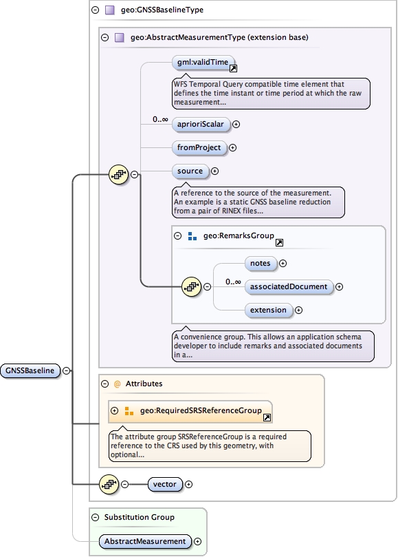
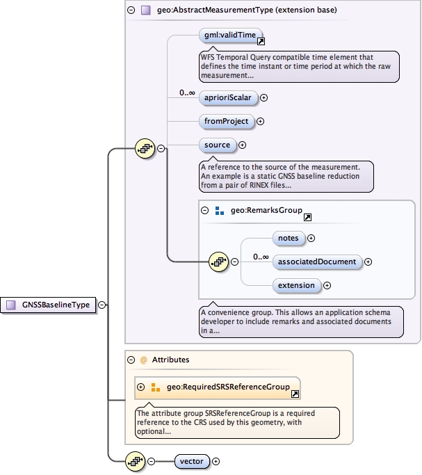
Element geo:GNSSBaseline
Namespace urn:xml-gov-au:icsm:egeodesy:0.4
Diagram
Type geo:GNSSBaselineType
Type hierarchy
Properties
Substitution Group Affiliation
Model
validTime{0,1} ,
geo:aprioriScalar* ,
geo:fromProject{0,1} ,
geo:source{0,1} ,
geo:notes{0,1} ,
geo:associatedDocument* ,
geo:extension{0,1} ,
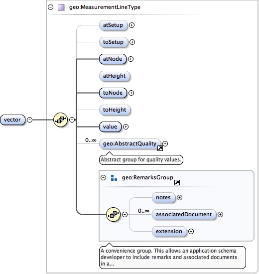
geo:vector
Children geo:aprioriScalar geo:associatedDocument geo:extension geo:fromProject geo:notes geo:source geo:vector validTime
Instance
<geo:GNSSBaseline srsDimension= "" srsName= "" xmlns:geo= "urn:xml-gov-au:icsm:egeodesy:0.4" >
<validTime > {0,1} </validTime>
<geo:aprioriScalar axisLabels= "" codeSpace= "" confidence= "" uomLabels= "" > {0,unbounded} </geo:aprioriScalar>
<geo:fromProject > {0,1} </geo:fromProject>
<geo:source > {0,1} </geo:source>
<geo:notes > {0,1} </geo:notes>
<geo:associatedDocument > {0,unbounded} </geo:associatedDocument>
<geo:extension > {0,1} </geo:extension>
<geo:vector > {1,1} </geo:vector>
</geo:GNSSBaseline>
Attributes
Source
<element name= "GNSSBaseline" substitutionGroup= "geo:AbstractMeasurement" type= "geo:GNSSBaselineType" />
Schema location file:/Users/boss/dev/GeodesyML/schemas/measurement.xsd
Namespace urn:xml-gov-au:icsm:egeodesy:0.4
Diagram
Type geo:MeasurementLineType
Type hierarchy
Properties
Model
geo:atSetup{0,1} ,
geo:toSetup{0,1} ,
geo:atNode ,
geo:atHeight{0,1} ,
geo:toNode ,
geo:toHeight{0,1} ,
geo:value ,
geo:AbstractQuality* ,
geo:notes{0,1} ,
geo:associatedDocument* ,
geo:extension{0,1}
Children geo:AbstractQuality geo:associatedDocument geo:atHeight geo:atNode geo:atSetup geo:extension geo:notes geo:toHeight geo:toNode geo:toSetup geo:value
Instance
<geo:vector xmlns:geo= "urn:xml-gov-au:icsm:egeodesy:0.4" >
<geo:atSetup > {0,1} </geo:atSetup>
<geo:toSetup > {0,1} </geo:toSetup>
<geo:atNode > {1,1} </geo:atNode>
<geo:atHeight > {0,1} </geo:atHeight>
<geo:toNode > {1,1} </geo:toNode>
<geo:toHeight > {0,1} </geo:toHeight>
<geo:value > {1,1} </geo:value>
<geo:AbstractQuality > {0,unbounded} </geo:AbstractQuality>
<geo:notes > {0,1} </geo:notes>
<geo:associatedDocument > {0,unbounded} </geo:associatedDocument>
<geo:extension > {0,1} </geo:extension>
</geo:vector>
Source
<element name= "vector" type= "geo:MeasurementLineType" />
Schema location file:/Users/boss/dev/GeodesyML/schemas/measurement.xsd
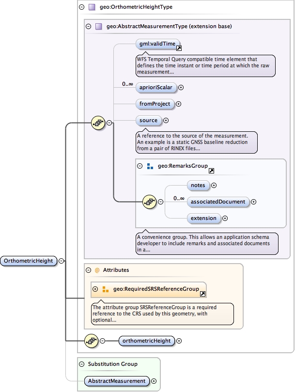
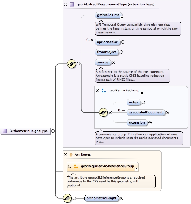
Element geo:OrthometricHeight
Namespace urn:xml-gov-au:icsm:egeodesy:0.4
Diagram
Type geo:OrthometricHeightType
Type hierarchy
Properties
Substitution Group Affiliation
Model
validTime{0,1} ,
geo:aprioriScalar* ,
geo:fromProject{0,1} ,
geo:source{0,1} ,
geo:notes{0,1} ,
geo:associatedDocument* ,
geo:extension{0,1} ,
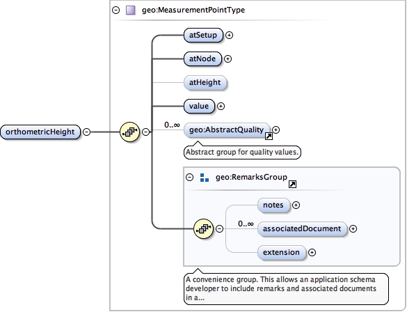
geo:orthometricHeight
Children geo:aprioriScalar geo:associatedDocument geo:extension geo:fromProject geo:notes geo:orthometricHeight geo:source validTime
Instance
<geo:OrthometricHeight srsDimension= "" srsName= "" xmlns:geo= "urn:xml-gov-au:icsm:egeodesy:0.4" >
<validTime > {0,1} </validTime>
<geo:aprioriScalar axisLabels= "" codeSpace= "" confidence= "" uomLabels= "" > {0,unbounded} </geo:aprioriScalar>
<geo:fromProject > {0,1} </geo:fromProject>
<geo:source > {0,1} </geo:source>
<geo:notes > {0,1} </geo:notes>
<geo:associatedDocument > {0,unbounded} </geo:associatedDocument>
<geo:extension > {0,1} </geo:extension>
<geo:orthometricHeight > {1,1} </geo:orthometricHeight>
</geo:OrthometricHeight>
Attributes
Source
<element name= "OrthometricHeight" substitutionGroup= "geo:AbstractMeasurement" type= "geo:OrthometricHeightType" />
Schema location file:/Users/boss/dev/GeodesyML/schemas/measurement.xsd
Namespace urn:xml-gov-au:icsm:egeodesy:0.4
Diagram
Type geo:MeasurementPointType
Type hierarchy
Properties
Model
geo:atSetup ,
geo:atNode ,
geo:atHeight{0,1} ,
geo:value ,
geo:AbstractQuality* ,
geo:notes{0,1} ,
geo:associatedDocument* ,
geo:extension{0,1}
Children geo:AbstractQuality geo:associatedDocument geo:atHeight geo:atNode geo:atSetup geo:extension geo:notes geo:value
Instance
<geo:orthometricHeight xmlns:geo= "urn:xml-gov-au:icsm:egeodesy:0.4" >
<geo:atSetup > {1,1} </geo:atSetup>
<geo:atNode > {1,1} </geo:atNode>
<geo:atHeight > {0,1} </geo:atHeight>
<geo:value uomLabel= "" > {1,1} </geo:value>
<geo:AbstractQuality > {0,unbounded} </geo:AbstractQuality>
<geo:notes > {0,1} </geo:notes>
<geo:associatedDocument > {0,unbounded} </geo:associatedDocument>
<geo:extension > {0,1} </geo:extension>
</geo:orthometricHeight>
Source
<element name= "orthometricHeight" type= "geo:MeasurementPointType" />
Schema location file:/Users/boss/dev/GeodesyML/schemas/measurement.xsd
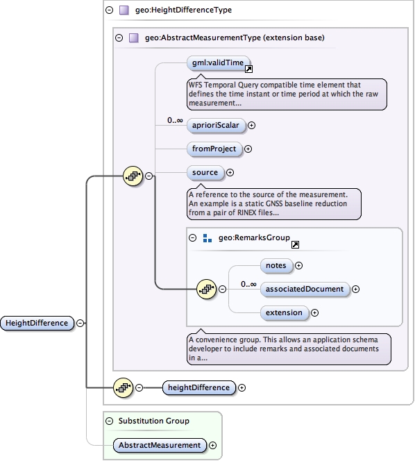
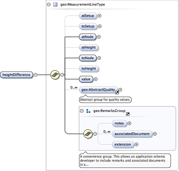
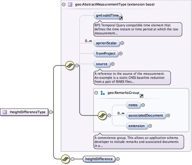
Element geo:HeightDifference
Namespace urn:xml-gov-au:icsm:egeodesy:0.4
Diagram
Type geo:HeightDifferenceType
Type hierarchy
Properties
Substitution Group Affiliation
Model
validTime{0,1} ,
geo:aprioriScalar* ,
geo:fromProject{0,1} ,
geo:source{0,1} ,
geo:notes{0,1} ,
geo:associatedDocument* ,
geo:extension{0,1} ,
geo:heightDifference
Children geo:aprioriScalar geo:associatedDocument geo:extension geo:fromProject geo:heightDifference geo:notes geo:source validTime
Instance
<geo:HeightDifference xmlns:geo= "urn:xml-gov-au:icsm:egeodesy:0.4" >
<validTime > {0,1} </validTime>
<geo:aprioriScalar axisLabels= "" codeSpace= "" confidence= "" uomLabels= "" > {0,unbounded} </geo:aprioriScalar>
<geo:fromProject > {0,1} </geo:fromProject>
<geo:source > {0,1} </geo:source>
<geo:notes > {0,1} </geo:notes>
<geo:associatedDocument > {0,unbounded} </geo:associatedDocument>
<geo:extension > {0,1} </geo:extension>
<geo:heightDifference > {1,1} </geo:heightDifference>
</geo:HeightDifference>
Source
<element name= "HeightDifference" substitutionGroup= "geo:AbstractMeasurement" type= "geo:HeightDifferenceType" />
Schema location file:/Users/boss/dev/GeodesyML/schemas/measurement.xsd
Namespace urn:xml-gov-au:icsm:egeodesy:0.4
Diagram
Type geo:MeasurementLineType
Type hierarchy
Properties
Model
geo:atSetup{0,1} ,
geo:toSetup{0,1} ,
geo:atNode ,
geo:atHeight{0,1} ,
geo:toNode ,
geo:toHeight{0,1} ,
geo:value ,
geo:AbstractQuality* ,
geo:notes{0,1} ,
geo:associatedDocument* ,
geo:extension{0,1}
Children geo:AbstractQuality geo:associatedDocument geo:atHeight geo:atNode geo:atSetup geo:extension geo:notes geo:toHeight geo:toNode geo:toSetup geo:value
Instance
<geo:heightDifference xmlns:geo= "urn:xml-gov-au:icsm:egeodesy:0.4" >
<geo:atSetup > {0,1} </geo:atSetup>
<geo:toSetup > {0,1} </geo:toSetup>
<geo:atNode > {1,1} </geo:atNode>
<geo:atHeight > {0,1} </geo:atHeight>
<geo:toNode > {1,1} </geo:toNode>
<geo:toHeight > {0,1} </geo:toHeight>
<geo:value > {1,1} </geo:value>
<geo:AbstractQuality > {0,unbounded} </geo:AbstractQuality>
<geo:notes > {0,1} </geo:notes>
<geo:associatedDocument > {0,unbounded} </geo:associatedDocument>
<geo:extension > {0,1} </geo:extension>
</geo:heightDifference>
Source
<element name= "heightDifference" type= "geo:MeasurementLineType" />
Schema location file:/Users/boss/dev/GeodesyML/schemas/measurement.xsd
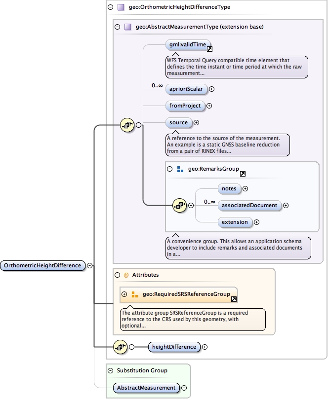
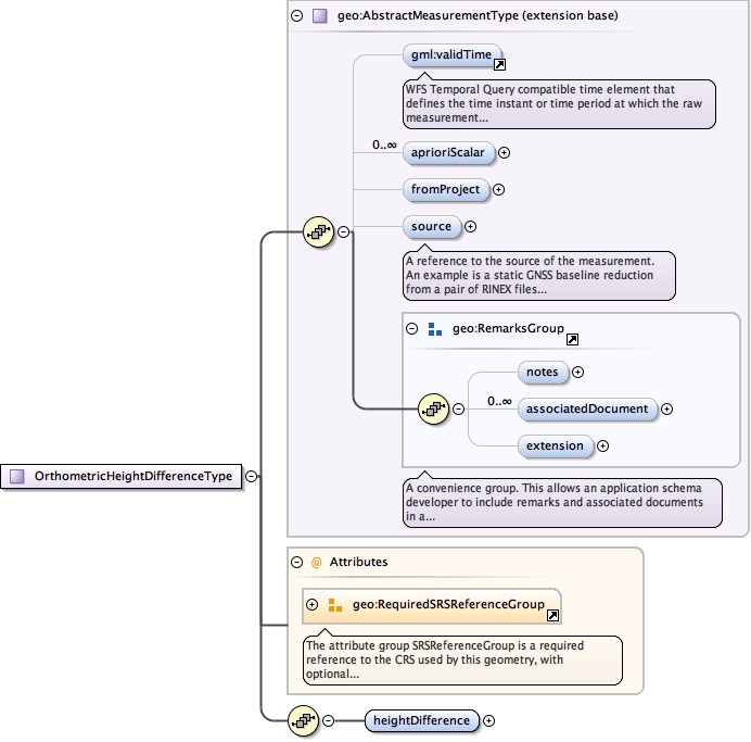
Element geo:OrthometricHeightDifference
Namespace urn:xml-gov-au:icsm:egeodesy:0.4
Diagram
Type geo:OrthometricHeightDifferenceType
Type hierarchy
Properties
Substitution Group Affiliation
Model
validTime{0,1} ,
geo:aprioriScalar* ,
geo:fromProject{0,1} ,
geo:source{0,1} ,
geo:notes{0,1} ,
geo:associatedDocument* ,
geo:extension{0,1} ,
geo:heightDifference
Children geo:aprioriScalar geo:associatedDocument geo:extension geo:fromProject geo:heightDifference geo:notes geo:source validTime
Instance
<geo:OrthometricHeightDifference srsDimension= "" srsName= "" xmlns:geo= "urn:xml-gov-au:icsm:egeodesy:0.4" >
<validTime > {0,1} </validTime>
<geo:aprioriScalar axisLabels= "" codeSpace= "" confidence= "" uomLabels= "" > {0,unbounded} </geo:aprioriScalar>
<geo:fromProject > {0,1} </geo:fromProject>
<geo:source > {0,1} </geo:source>
<geo:notes > {0,1} </geo:notes>
<geo:associatedDocument > {0,unbounded} </geo:associatedDocument>
<geo:extension > {0,1} </geo:extension>
<geo:heightDifference > {1,1} </geo:heightDifference>
</geo:OrthometricHeightDifference>
Attributes
Source
<element name= "OrthometricHeightDifference" substitutionGroup= "geo:AbstractMeasurement" type= "geo:OrthometricHeightDifferenceType" />
Schema location file:/Users/boss/dev/GeodesyML/schemas/measurement.xsd
Namespace urn:xml-gov-au:icsm:egeodesy:0.4
Diagram
Type geo:MeasurementLineType
Type hierarchy
Properties
Model
geo:atSetup{0,1} ,
geo:toSetup{0,1} ,
geo:atNode ,
geo:atHeight{0,1} ,
geo:toNode ,
geo:toHeight{0,1} ,
geo:value ,
geo:AbstractQuality* ,
geo:notes{0,1} ,
geo:associatedDocument* ,
geo:extension{0,1}
Children geo:AbstractQuality geo:associatedDocument geo:atHeight geo:atNode geo:atSetup geo:extension geo:notes geo:toHeight geo:toNode geo:toSetup geo:value
Instance
<geo:heightDifference xmlns:geo= "urn:xml-gov-au:icsm:egeodesy:0.4" >
<geo:atSetup > {0,1} </geo:atSetup>
<geo:toSetup > {0,1} </geo:toSetup>
<geo:atNode > {1,1} </geo:atNode>
<geo:atHeight > {0,1} </geo:atHeight>
<geo:toNode > {1,1} </geo:toNode>
<geo:toHeight > {0,1} </geo:toHeight>
<geo:value > {1,1} </geo:value>
<geo:AbstractQuality > {0,unbounded} </geo:AbstractQuality>
<geo:notes > {0,1} </geo:notes>
<geo:associatedDocument > {0,unbounded} </geo:associatedDocument>
<geo:extension > {0,1} </geo:extension>
</geo:heightDifference>
Source
<element name= "heightDifference" type= "geo:MeasurementLineType" />
Schema location file:/Users/boss/dev/GeodesyML/schemas/measurement.xsd
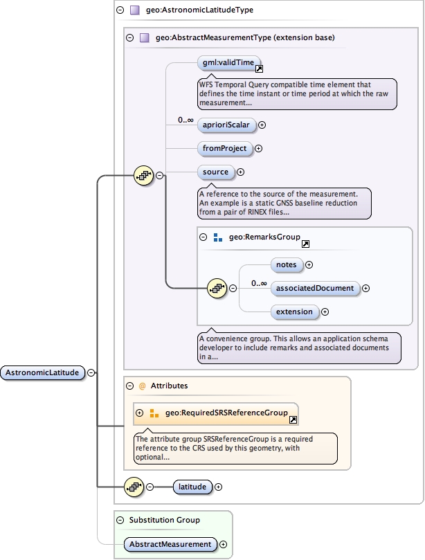
Element geo:AstronomicLatitude
Namespace urn:xml-gov-au:icsm:egeodesy:0.4
Diagram
Type geo:AstronomicLatitudeType
Type hierarchy
Properties
Substitution Group Affiliation
Model
validTime{0,1} ,
geo:aprioriScalar* ,
geo:fromProject{0,1} ,
geo:source{0,1} ,
geo:notes{0,1} ,
geo:associatedDocument* ,
geo:extension{0,1} ,
geo:latitude
Children geo:aprioriScalar geo:associatedDocument geo:extension geo:fromProject geo:latitude geo:notes geo:source validTime
Instance
<geo:AstronomicLatitude srsDimension= "" srsName= "" xmlns:geo= "urn:xml-gov-au:icsm:egeodesy:0.4" >
<validTime > {0,1} </validTime>
<geo:aprioriScalar axisLabels= "" codeSpace= "" confidence= "" uomLabels= "" > {0,unbounded} </geo:aprioriScalar>
<geo:fromProject > {0,1} </geo:fromProject>
<geo:source > {0,1} </geo:source>
<geo:notes > {0,1} </geo:notes>
<geo:associatedDocument > {0,unbounded} </geo:associatedDocument>
<geo:extension > {0,1} </geo:extension>
<geo:latitude > {1,1} </geo:latitude>
</geo:AstronomicLatitude>
Attributes
Source
<element name= "AstronomicLatitude" substitutionGroup= "geo:AbstractMeasurement" type= "geo:AstronomicLatitudeType" />
Schema location file:/Users/boss/dev/GeodesyML/schemas/measurement.xsd
Namespace urn:xml-gov-au:icsm:egeodesy:0.4
Diagram
Type geo:MeasurementPointType
Type hierarchy
Properties
Model
geo:atSetup ,
geo:atNode ,
geo:atHeight{0,1} ,
geo:value ,
geo:AbstractQuality* ,
geo:notes{0,1} ,
geo:associatedDocument* ,
geo:extension{0,1}
Children geo:AbstractQuality geo:associatedDocument geo:atHeight geo:atNode geo:atSetup geo:extension geo:notes geo:value
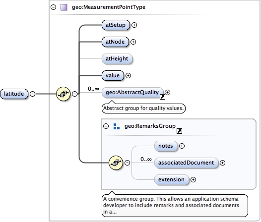
Instance
<geo:latitude xmlns:geo= "urn:xml-gov-au:icsm:egeodesy:0.4" >
<geo:atSetup > {1,1} </geo:atSetup>
<geo:atNode > {1,1} </geo:atNode>
<geo:atHeight > {0,1} </geo:atHeight>
<geo:value uomLabel= "" > {1,1} </geo:value>
<geo:AbstractQuality > {0,unbounded} </geo:AbstractQuality>
<geo:notes > {0,1} </geo:notes>
<geo:associatedDocument > {0,unbounded} </geo:associatedDocument>
<geo:extension > {0,1} </geo:extension>
</geo:latitude>
Source
<element name= "latitude" type= "geo:MeasurementPointType" />
Schema location file:/Users/boss/dev/GeodesyML/schemas/measurement.xsd
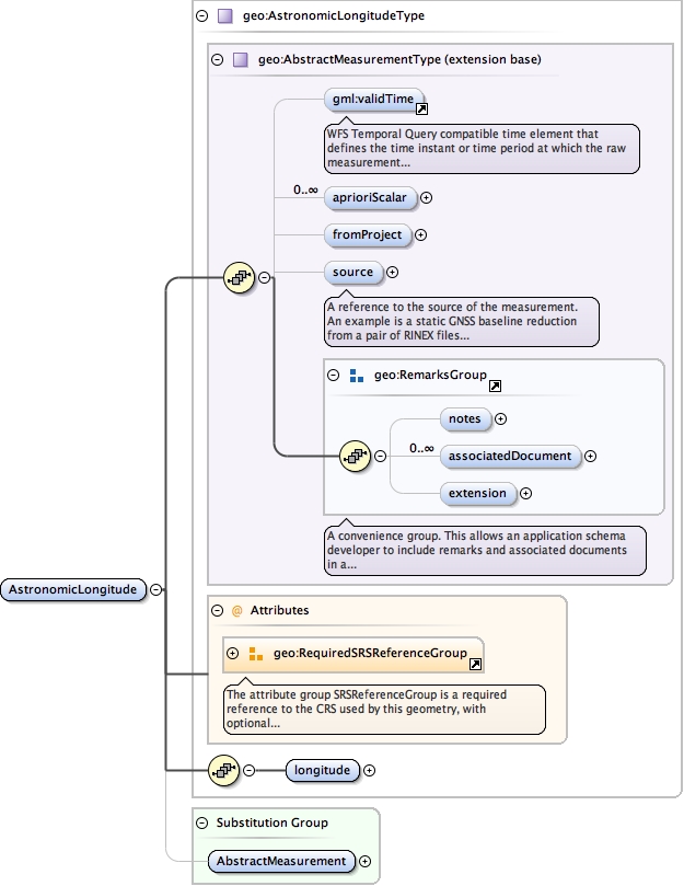
Element geo:AstronomicLongitude
Namespace urn:xml-gov-au:icsm:egeodesy:0.4
Diagram
Type geo:AstronomicLongitudeType
Type hierarchy
Properties
Substitution Group Affiliation
Model
validTime{0,1} ,
geo:aprioriScalar* ,
geo:fromProject{0,1} ,
geo:source{0,1} ,
geo:notes{0,1} ,
geo:associatedDocument* ,
geo:extension{0,1} ,
geo:longitude
Children geo:aprioriScalar geo:associatedDocument geo:extension geo:fromProject geo:longitude geo:notes geo:source validTime
Instance
<geo:AstronomicLongitude srsDimension= "" srsName= "" xmlns:geo= "urn:xml-gov-au:icsm:egeodesy:0.4" >
<validTime > {0,1} </validTime>
<geo:aprioriScalar axisLabels= "" codeSpace= "" confidence= "" uomLabels= "" > {0,unbounded} </geo:aprioriScalar>
<geo:fromProject > {0,1} </geo:fromProject>
<geo:source > {0,1} </geo:source>
<geo:notes > {0,1} </geo:notes>
<geo:associatedDocument > {0,unbounded} </geo:associatedDocument>
<geo:extension > {0,1} </geo:extension>
<geo:longitude > {1,1} </geo:longitude>
</geo:AstronomicLongitude>
Attributes
Source
<element name= "AstronomicLongitude" substitutionGroup= "geo:AbstractMeasurement" type= "geo:AstronomicLongitudeType" />
Schema location file:/Users/boss/dev/GeodesyML/schemas/measurement.xsd
Namespace urn:xml-gov-au:icsm:egeodesy:0.4
Diagram
Type geo:MeasurementPointType
Type hierarchy
Properties
Model
geo:atSetup ,
geo:atNode ,
geo:atHeight{0,1} ,
geo:value ,
geo:AbstractQuality* ,
geo:notes{0,1} ,
geo:associatedDocument* ,
geo:extension{0,1}
Children geo:AbstractQuality geo:associatedDocument geo:atHeight geo:atNode geo:atSetup geo:extension geo:notes geo:value
Instance
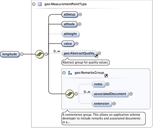
<geo:longitude xmlns:geo= "urn:xml-gov-au:icsm:egeodesy:0.4" >
<geo:atSetup > {1,1} </geo:atSetup>
<geo:atNode > {1,1} </geo:atNode>
<geo:atHeight > {0,1} </geo:atHeight>
<geo:value uomLabel= "" > {1,1} </geo:value>
<geo:AbstractQuality > {0,unbounded} </geo:AbstractQuality>
<geo:notes > {0,1} </geo:notes>
<geo:associatedDocument > {0,unbounded} </geo:associatedDocument>
<geo:extension > {0,1} </geo:extension>
</geo:longitude>
Source
<element name= "longitude" type= "geo:MeasurementPointType" />
Schema location file:/Users/boss/dev/GeodesyML/schemas/measurement.xsd
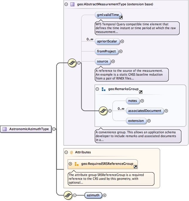
Element geo:AstronomicAzimuth
Namespace urn:xml-gov-au:icsm:egeodesy:0.4
Diagram
Type geo:AstronomicAzimuthType
Type hierarchy
Properties
Substitution Group Affiliation
Model
validTime{0,1} ,
geo:aprioriScalar* ,
geo:fromProject{0,1} ,
geo:source{0,1} ,
geo:notes{0,1} ,
geo:associatedDocument* ,
geo:extension{0,1} ,
geo:azimuth
Children geo:aprioriScalar geo:associatedDocument geo:azimuth geo:extension geo:fromProject geo:notes geo:source validTime
Instance
<geo:AstronomicAzimuth srsDimension= "" srsName= "" xmlns:geo= "urn:xml-gov-au:icsm:egeodesy:0.4" >
<validTime > {0,1} </validTime>
<geo:aprioriScalar axisLabels= "" codeSpace= "" confidence= "" uomLabels= "" > {0,unbounded} </geo:aprioriScalar>
<geo:fromProject > {0,1} </geo:fromProject>
<geo:source > {0,1} </geo:source>
<geo:notes > {0,1} </geo:notes>
<geo:associatedDocument > {0,unbounded} </geo:associatedDocument>
<geo:extension > {0,1} </geo:extension>
<geo:azimuth > {1,1} </geo:azimuth>
</geo:AstronomicAzimuth>
Attributes
Source
<element name= "AstronomicAzimuth" substitutionGroup= "geo:AbstractMeasurement" type= "geo:AstronomicAzimuthType" />
Schema location file:/Users/boss/dev/GeodesyML/schemas/measurement.xsd
Namespace urn:xml-gov-au:icsm:egeodesy:0.4
Diagram
Type geo:MeasurementLineType
Type hierarchy
Properties
Model
geo:atSetup{0,1} ,
geo:toSetup{0,1} ,
geo:atNode ,
geo:atHeight{0,1} ,
geo:toNode ,
geo:toHeight{0,1} ,
geo:value ,
geo:AbstractQuality* ,
geo:notes{0,1} ,
geo:associatedDocument* ,
geo:extension{0,1}
Children geo:AbstractQuality geo:associatedDocument geo:atHeight geo:atNode geo:atSetup geo:extension geo:notes geo:toHeight geo:toNode geo:toSetup geo:value
Instance
<geo:azimuth xmlns:geo= "urn:xml-gov-au:icsm:egeodesy:0.4" >
<geo:atSetup > {0,1} </geo:atSetup>
<geo:toSetup > {0,1} </geo:toSetup>
<geo:atNode > {1,1} </geo:atNode>
<geo:atHeight > {0,1} </geo:atHeight>
<geo:toNode > {1,1} </geo:toNode>
<geo:toHeight > {0,1} </geo:toHeight>
<geo:value > {1,1} </geo:value>
<geo:AbstractQuality > {0,unbounded} </geo:AbstractQuality>
<geo:notes > {0,1} </geo:notes>
<geo:associatedDocument > {0,unbounded} </geo:associatedDocument>
<geo:extension > {0,1} </geo:extension>
</geo:azimuth>
Source
<element name= "azimuth" type= "geo:MeasurementLineType" />
Schema location file:/Users/boss/dev/GeodesyML/schemas/measurement.xsd
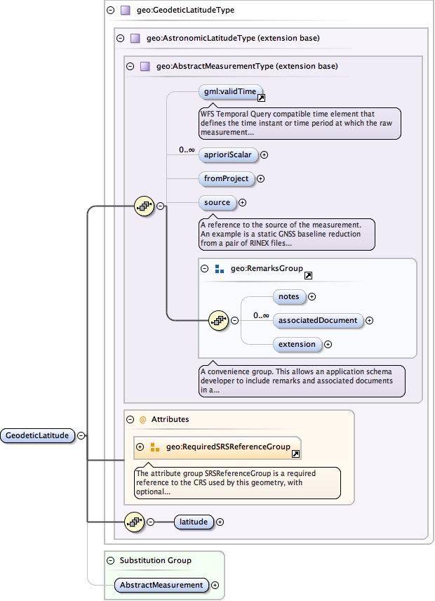
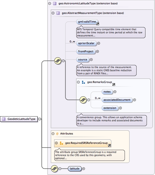
Element geo:GeodeticLatitude
Namespace urn:xml-gov-au:icsm:egeodesy:0.4
Diagram
Type geo:GeodeticLatitudeType
Type hierarchy
Properties
Substitution Group Affiliation
Model
validTime{0,1} ,
geo:aprioriScalar* ,
geo:fromProject{0,1} ,
geo:source{0,1} ,
geo:notes{0,1} ,
geo:associatedDocument* ,
geo:extension{0,1} ,
geo:latitude
Children geo:aprioriScalar geo:associatedDocument geo:extension geo:fromProject geo:latitude geo:notes geo:source validTime
Instance
<geo:GeodeticLatitude srsDimension= "" srsName= "" xmlns:geo= "urn:xml-gov-au:icsm:egeodesy:0.4" >
<validTime > {0,1} </validTime>
<geo:aprioriScalar axisLabels= "" codeSpace= "" confidence= "" uomLabels= "" > {0,unbounded} </geo:aprioriScalar>
<geo:fromProject > {0,1} </geo:fromProject>
<geo:source > {0,1} </geo:source>
<geo:notes > {0,1} </geo:notes>
<geo:associatedDocument > {0,unbounded} </geo:associatedDocument>
<geo:extension > {0,1} </geo:extension>
<geo:latitude > {1,1} </geo:latitude>
</geo:GeodeticLatitude>
Attributes
Source
<element name= "GeodeticLatitude" substitutionGroup= "geo:AbstractMeasurement" type= "geo:GeodeticLatitudeType" />
Schema location file:/Users/boss/dev/GeodesyML/schemas/measurement.xsd
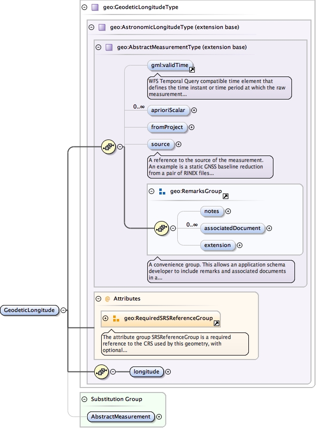
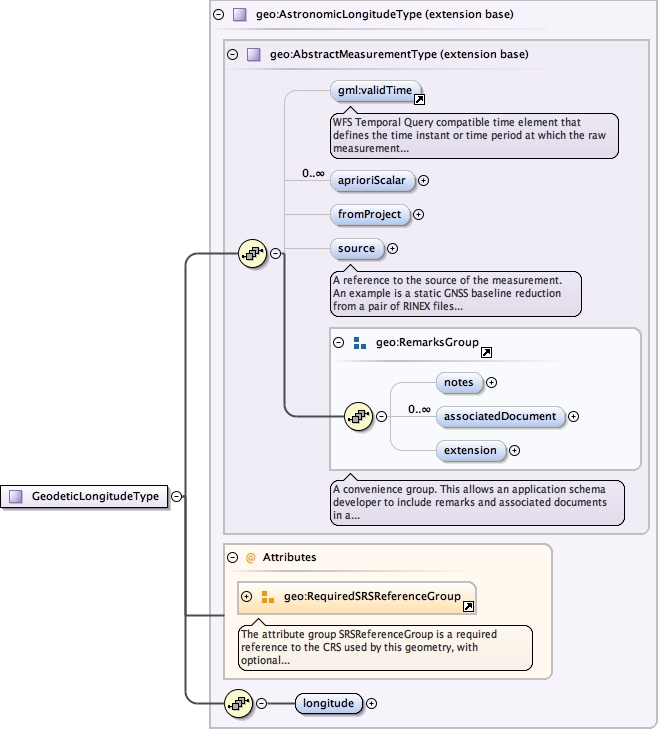
Element geo:GeodeticLongitude
Namespace urn:xml-gov-au:icsm:egeodesy:0.4
Diagram
Type geo:GeodeticLongitudeType
Type hierarchy
Properties
Substitution Group Affiliation
Model
validTime{0,1} ,
geo:aprioriScalar* ,
geo:fromProject{0,1} ,
geo:source{0,1} ,
geo:notes{0,1} ,
geo:associatedDocument* ,
geo:extension{0,1} ,
geo:longitude
Children geo:aprioriScalar geo:associatedDocument geo:extension geo:fromProject geo:longitude geo:notes geo:source validTime
Instance
<geo:GeodeticLongitude srsDimension= "" srsName= "" xmlns:geo= "urn:xml-gov-au:icsm:egeodesy:0.4" >
<validTime > {0,1} </validTime>
<geo:aprioriScalar axisLabels= "" codeSpace= "" confidence= "" uomLabels= "" > {0,unbounded} </geo:aprioriScalar>
<geo:fromProject > {0,1} </geo:fromProject>
<geo:source > {0,1} </geo:source>
<geo:notes > {0,1} </geo:notes>
<geo:associatedDocument > {0,unbounded} </geo:associatedDocument>
<geo:extension > {0,1} </geo:extension>
<geo:longitude > {1,1} </geo:longitude>
</geo:GeodeticLongitude>
Attributes
Source
<element name= "GeodeticLongitude" substitutionGroup= "geo:AbstractMeasurement" type= "geo:GeodeticLongitudeType" />
Schema location file:/Users/boss/dev/GeodesyML/schemas/measurement.xsd
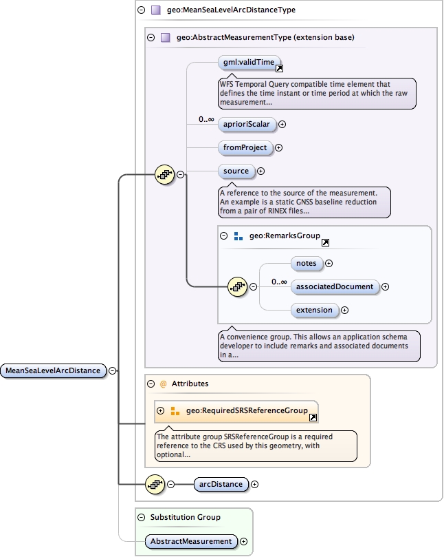
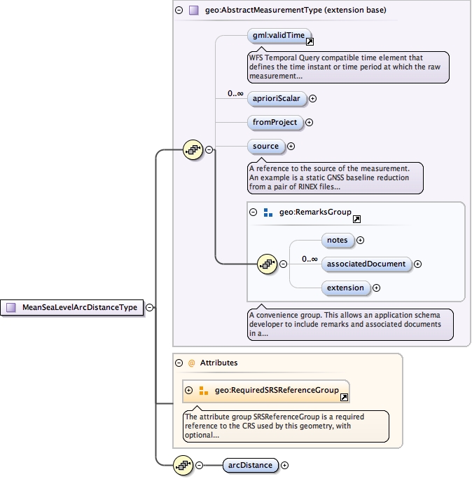
Element geo:MeanSeaLevelArcDistance
Namespace urn:xml-gov-au:icsm:egeodesy:0.4
Diagram
Type geo:MeanSeaLevelArcDistanceType
Type hierarchy
Properties
Substitution Group Affiliation
Model
validTime{0,1} ,
geo:aprioriScalar* ,
geo:fromProject{0,1} ,
geo:source{0,1} ,
geo:notes{0,1} ,
geo:associatedDocument* ,
geo:extension{0,1} ,
geo:arcDistance
Children geo:aprioriScalar geo:arcDistance geo:associatedDocument geo:extension geo:fromProject geo:notes geo:source validTime
Instance
<geo:MeanSeaLevelArcDistance srsDimension= "" srsName= "" xmlns:geo= "urn:xml-gov-au:icsm:egeodesy:0.4" >
<validTime > {0,1} </validTime>
<geo:aprioriScalar axisLabels= "" codeSpace= "" confidence= "" uomLabels= "" > {0,unbounded} </geo:aprioriScalar>
<geo:fromProject > {0,1} </geo:fromProject>
<geo:source > {0,1} </geo:source>
<geo:notes > {0,1} </geo:notes>
<geo:associatedDocument > {0,unbounded} </geo:associatedDocument>
<geo:extension > {0,1} </geo:extension>
<geo:arcDistance > {1,1} </geo:arcDistance>
</geo:MeanSeaLevelArcDistance>
Attributes
Source
<element name= "MeanSeaLevelArcDistance" substitutionGroup= "geo:AbstractMeasurement" type= "geo:MeanSeaLevelArcDistanceType" />
Schema location file:/Users/boss/dev/GeodesyML/schemas/measurement.xsd
Namespace urn:xml-gov-au:icsm:egeodesy:0.4
Diagram
Type geo:MeasurementLineType
Type hierarchy
Properties
Model
geo:atSetup{0,1} ,
geo:toSetup{0,1} ,
geo:atNode ,
geo:atHeight{0,1} ,
geo:toNode ,
geo:toHeight{0,1} ,
geo:value ,
geo:AbstractQuality* ,
geo:notes{0,1} ,
geo:associatedDocument* ,
geo:extension{0,1}
Children geo:AbstractQuality geo:associatedDocument geo:atHeight geo:atNode geo:atSetup geo:extension geo:notes geo:toHeight geo:toNode geo:toSetup geo:value
Instance
<geo:arcDistance xmlns:geo= "urn:xml-gov-au:icsm:egeodesy:0.4" >
<geo:atSetup > {0,1} </geo:atSetup>
<geo:toSetup > {0,1} </geo:toSetup>
<geo:atNode > {1,1} </geo:atNode>
<geo:atHeight > {0,1} </geo:atHeight>
<geo:toNode > {1,1} </geo:toNode>
<geo:toHeight > {0,1} </geo:toHeight>
<geo:value > {1,1} </geo:value>
<geo:AbstractQuality > {0,unbounded} </geo:AbstractQuality>
<geo:notes > {0,1} </geo:notes>
<geo:associatedDocument > {0,unbounded} </geo:associatedDocument>
<geo:extension > {0,1} </geo:extension>
</geo:arcDistance>
Source
<element name= "arcDistance" type= "geo:MeasurementLineType" />
Schema location file:/Users/boss/dev/GeodesyML/schemas/measurement.xsd
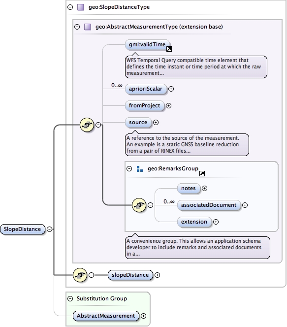
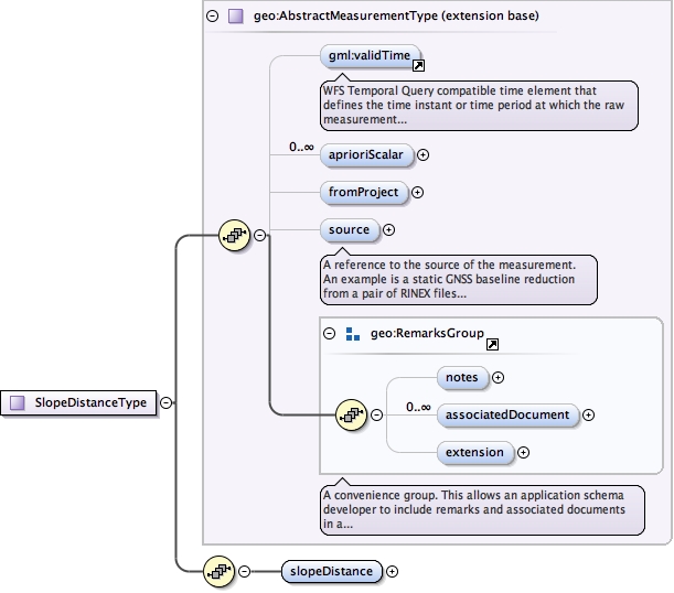
Element geo:SlopeDistance
Namespace urn:xml-gov-au:icsm:egeodesy:0.4
Diagram
Type geo:SlopeDistanceType
Type hierarchy
Properties
Substitution Group Affiliation
Model
validTime{0,1} ,
geo:aprioriScalar* ,
geo:fromProject{0,1} ,
geo:source{0,1} ,
geo:notes{0,1} ,
geo:associatedDocument* ,
geo:extension{0,1} ,
geo:slopeDistance
Children geo:aprioriScalar geo:associatedDocument geo:extension geo:fromProject geo:notes geo:slopeDistance geo:source validTime
Instance
<geo:SlopeDistance xmlns:geo= "urn:xml-gov-au:icsm:egeodesy:0.4" >
<validTime > {0,1} </validTime>
<geo:aprioriScalar axisLabels= "" codeSpace= "" confidence= "" uomLabels= "" > {0,unbounded} </geo:aprioriScalar>
<geo:fromProject > {0,1} </geo:fromProject>
<geo:source > {0,1} </geo:source>
<geo:notes > {0,1} </geo:notes>
<geo:associatedDocument > {0,unbounded} </geo:associatedDocument>
<geo:extension > {0,1} </geo:extension>
<geo:slopeDistance > {1,1} </geo:slopeDistance>
</geo:SlopeDistance>
Source
<element name= "SlopeDistance" substitutionGroup= "geo:AbstractMeasurement" type= "geo:SlopeDistanceType" />
Schema location file:/Users/boss/dev/GeodesyML/schemas/measurement.xsd
Namespace urn:xml-gov-au:icsm:egeodesy:0.4
Diagram
Type geo:MeasurementLineType
Type hierarchy
Properties
Model
geo:atSetup{0,1} ,
geo:toSetup{0,1} ,
geo:atNode ,
geo:atHeight{0,1} ,
geo:toNode ,
geo:toHeight{0,1} ,
geo:value ,
geo:AbstractQuality* ,
geo:notes{0,1} ,
geo:associatedDocument* ,
geo:extension{0,1}
Children geo:AbstractQuality geo:associatedDocument geo:atHeight geo:atNode geo:atSetup geo:extension geo:notes geo:toHeight geo:toNode geo:toSetup geo:value
Instance
<geo:slopeDistance xmlns:geo= "urn:xml-gov-au:icsm:egeodesy:0.4" >
<geo:atSetup > {0,1} </geo:atSetup>
<geo:toSetup > {0,1} </geo:toSetup>
<geo:atNode > {1,1} </geo:atNode>
<geo:atHeight > {0,1} </geo:atHeight>
<geo:toNode > {1,1} </geo:toNode>
<geo:toHeight > {0,1} </geo:toHeight>
<geo:value > {1,1} </geo:value>
<geo:AbstractQuality > {0,unbounded} </geo:AbstractQuality>
<geo:notes > {0,1} </geo:notes>
<geo:associatedDocument > {0,unbounded} </geo:associatedDocument>
<geo:extension > {0,1} </geo:extension>
</geo:slopeDistance>
Source
<element name= "slopeDistance" type= "geo:MeasurementLineType" />
Schema location file:/Users/boss/dev/GeodesyML/schemas/measurement.xsd
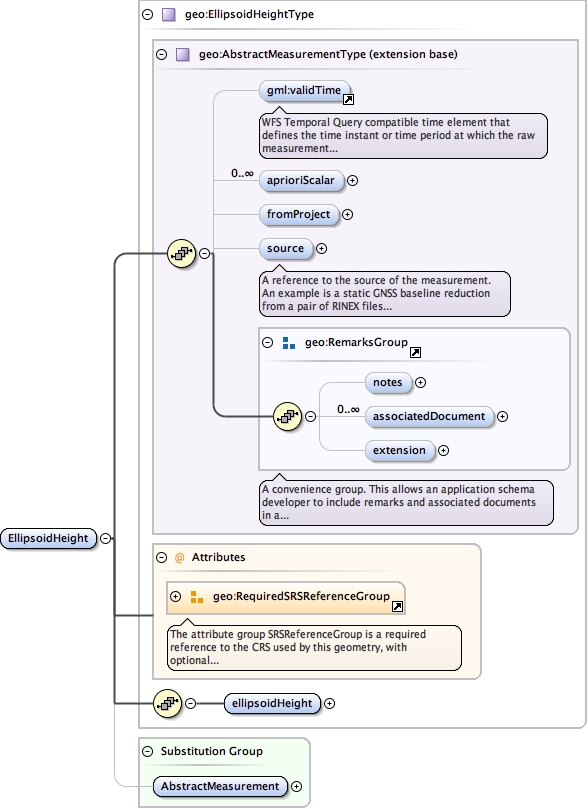
Element geo:EllipsoidHeight
Namespace urn:xml-gov-au:icsm:egeodesy:0.4
Diagram
Type geo:EllipsoidHeightType
Type hierarchy
Properties
Substitution Group Affiliation
Model
validTime{0,1} ,
geo:aprioriScalar* ,
geo:fromProject{0,1} ,
geo:source{0,1} ,
geo:notes{0,1} ,
geo:associatedDocument* ,
geo:extension{0,1} ,
geo:ellipsoidHeight
Children geo:aprioriScalar geo:associatedDocument geo:ellipsoidHeight geo:extension geo:fromProject geo:notes geo:source validTime
Instance
<geo:EllipsoidHeight srsDimension= "" srsName= "" xmlns:geo= "urn:xml-gov-au:icsm:egeodesy:0.4" >
<validTime > {0,1} </validTime>
<geo:aprioriScalar axisLabels= "" codeSpace= "" confidence= "" uomLabels= "" > {0,unbounded} </geo:aprioriScalar>
<geo:fromProject > {0,1} </geo:fromProject>
<geo:source > {0,1} </geo:source>
<geo:notes > {0,1} </geo:notes>
<geo:associatedDocument > {0,unbounded} </geo:associatedDocument>
<geo:extension > {0,1} </geo:extension>
<geo:ellipsoidHeight > {1,1} </geo:ellipsoidHeight>
</geo:EllipsoidHeight>
Attributes
Source
<element name= "EllipsoidHeight" substitutionGroup= "geo:AbstractMeasurement" type= "geo:EllipsoidHeightType" />
Schema location file:/Users/boss/dev/GeodesyML/schemas/measurement.xsd
Namespace urn:xml-gov-au:icsm:egeodesy:0.4
Diagram
Type geo:MeasurementPointType
Type hierarchy
Properties
Model
geo:atSetup ,
geo:atNode ,
geo:atHeight{0,1} ,
geo:value ,
geo:AbstractQuality* ,
geo:notes{0,1} ,
geo:associatedDocument* ,
geo:extension{0,1}
Children geo:AbstractQuality geo:associatedDocument geo:atHeight geo:atNode geo:atSetup geo:extension geo:notes geo:value
Instance
<geo:ellipsoidHeight xmlns:geo= "urn:xml-gov-au:icsm:egeodesy:0.4" >
<geo:atSetup > {1,1} </geo:atSetup>
<geo:atNode > {1,1} </geo:atNode>
<geo:atHeight > {0,1} </geo:atHeight>
<geo:value uomLabel= "" > {1,1} </geo:value>
<geo:AbstractQuality > {0,unbounded} </geo:AbstractQuality>
<geo:notes > {0,1} </geo:notes>
<geo:associatedDocument > {0,unbounded} </geo:associatedDocument>
<geo:extension > {0,1} </geo:extension>
</geo:ellipsoidHeight>
Source
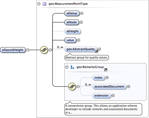
<element name= "ellipsoidHeight" type= "geo:MeasurementPointType" />
Schema location file:/Users/boss/dev/GeodesyML/schemas/measurement.xsd
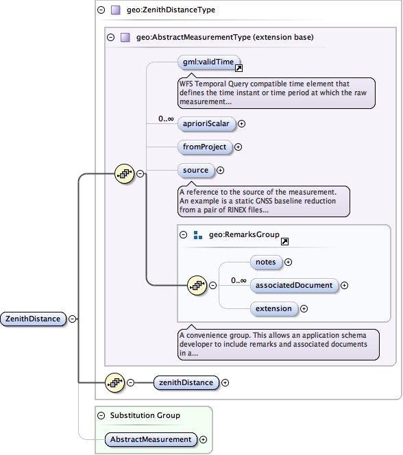
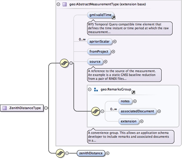
Element geo:ZenithDistance
Namespace urn:xml-gov-au:icsm:egeodesy:0.4
Diagram
Type geo:ZenithDistanceType
Type hierarchy
Properties
Substitution Group Affiliation
Model
validTime{0,1} ,
geo:aprioriScalar* ,
geo:fromProject{0,1} ,
geo:source{0,1} ,
geo:notes{0,1} ,
geo:associatedDocument* ,
geo:extension{0,1} ,
geo:zenithDistance
Children geo:aprioriScalar geo:associatedDocument geo:extension geo:fromProject geo:notes geo:source geo:zenithDistance validTime
Instance
<geo:ZenithDistance xmlns:geo= "urn:xml-gov-au:icsm:egeodesy:0.4" >
<validTime > {0,1} </validTime>
<geo:aprioriScalar axisLabels= "" codeSpace= "" confidence= "" uomLabels= "" > {0,unbounded} </geo:aprioriScalar>
<geo:fromProject > {0,1} </geo:fromProject>
<geo:source > {0,1} </geo:source>
<geo:notes > {0,1} </geo:notes>
<geo:associatedDocument > {0,unbounded} </geo:associatedDocument>
<geo:extension > {0,1} </geo:extension>
<geo:zenithDistance > {1,1} </geo:zenithDistance>
</geo:ZenithDistance>
Source
<element name= "ZenithDistance" substitutionGroup= "geo:AbstractMeasurement" type= "geo:ZenithDistanceType" />
Schema location file:/Users/boss/dev/GeodesyML/schemas/measurement.xsd
Namespace urn:xml-gov-au:icsm:egeodesy:0.4
Diagram
Type geo:MeasurementLineType
Type hierarchy
Properties
Model
geo:atSetup{0,1} ,
geo:toSetup{0,1} ,
geo:atNode ,
geo:atHeight{0,1} ,
geo:toNode ,
geo:toHeight{0,1} ,
geo:value ,
geo:AbstractQuality* ,
geo:notes{0,1} ,
geo:associatedDocument* ,
geo:extension{0,1}
Children geo:AbstractQuality geo:associatedDocument geo:atHeight geo:atNode geo:atSetup geo:extension geo:notes geo:toHeight geo:toNode geo:toSetup geo:value
Instance
<geo:zenithDistance xmlns:geo= "urn:xml-gov-au:icsm:egeodesy:0.4" >
<geo:atSetup > {0,1} </geo:atSetup>
<geo:toSetup > {0,1} </geo:toSetup>
<geo:atNode > {1,1} </geo:atNode>
<geo:atHeight > {0,1} </geo:atHeight>
<geo:toNode > {1,1} </geo:toNode>
<geo:toHeight > {0,1} </geo:toHeight>
<geo:value > {1,1} </geo:value>
<geo:AbstractQuality > {0,unbounded} </geo:AbstractQuality>
<geo:notes > {0,1} </geo:notes>
<geo:associatedDocument > {0,unbounded} </geo:associatedDocument>
<geo:extension > {0,1} </geo:extension>
</geo:zenithDistance>
Source
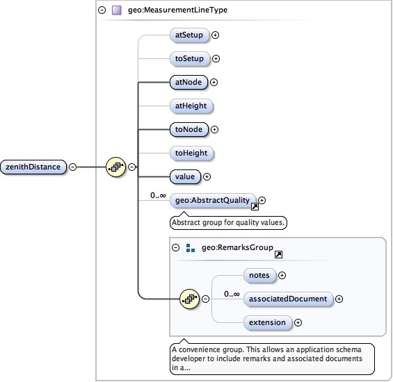
<element name= "zenithDistance" type= "geo:MeasurementLineType" />
Schema location file:/Users/boss/dev/GeodesyML/schemas/measurement.xsd
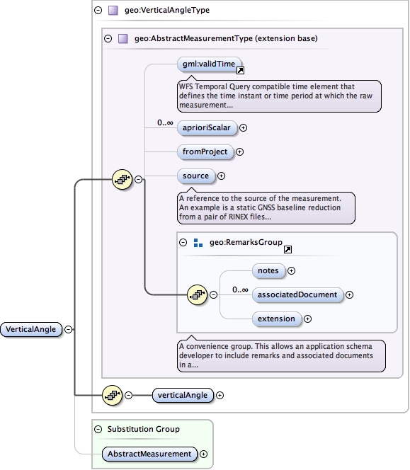
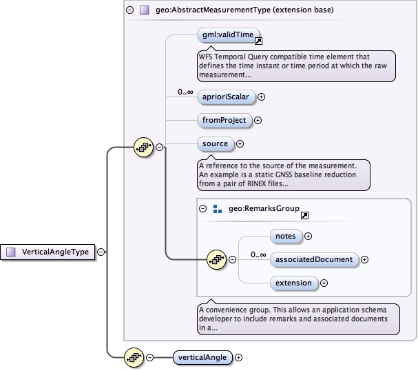
Element geo:VerticalAngle
Namespace urn:xml-gov-au:icsm:egeodesy:0.4
Diagram
Type geo:VerticalAngleType
Type hierarchy
Properties
Substitution Group Affiliation
Model
validTime{0,1} ,
geo:aprioriScalar* ,
geo:fromProject{0,1} ,
geo:source{0,1} ,
geo:notes{0,1} ,
geo:associatedDocument* ,
geo:extension{0,1} ,
geo:verticalAngle
Children geo:aprioriScalar geo:associatedDocument geo:extension geo:fromProject geo:notes geo:source geo:verticalAngle validTime
Instance
<geo:VerticalAngle xmlns:geo= "urn:xml-gov-au:icsm:egeodesy:0.4" >
<validTime > {0,1} </validTime>
<geo:aprioriScalar axisLabels= "" codeSpace= "" confidence= "" uomLabels= "" > {0,unbounded} </geo:aprioriScalar>
<geo:fromProject > {0,1} </geo:fromProject>
<geo:source > {0,1} </geo:source>
<geo:notes > {0,1} </geo:notes>
<geo:associatedDocument > {0,unbounded} </geo:associatedDocument>
<geo:extension > {0,1} </geo:extension>
<geo:verticalAngle > {1,1} </geo:verticalAngle>
</geo:VerticalAngle>
Source
<element name= "VerticalAngle" substitutionGroup= "geo:AbstractMeasurement" type= "geo:VerticalAngleType" />
Schema location file:/Users/boss/dev/GeodesyML/schemas/measurement.xsd
Namespace urn:xml-gov-au:icsm:egeodesy:0.4
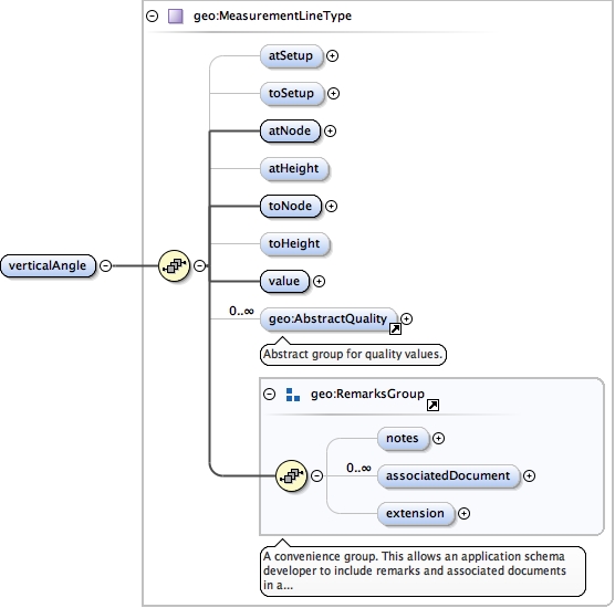
Diagram
Type geo:MeasurementLineType
Type hierarchy
Properties
Model
geo:atSetup{0,1} ,
geo:toSetup{0,1} ,
geo:atNode ,
geo:atHeight{0,1} ,
geo:toNode ,
geo:toHeight{0,1} ,
geo:value ,
geo:AbstractQuality* ,
geo:notes{0,1} ,
geo:associatedDocument* ,
geo:extension{0,1}
Children geo:AbstractQuality geo:associatedDocument geo:atHeight geo:atNode geo:atSetup geo:extension geo:notes geo:toHeight geo:toNode geo:toSetup geo:value
Instance
<geo:verticalAngle xmlns:geo= "urn:xml-gov-au:icsm:egeodesy:0.4" >
<geo:atSetup > {0,1} </geo:atSetup>
<geo:toSetup > {0,1} </geo:toSetup>
<geo:atNode > {1,1} </geo:atNode>
<geo:atHeight > {0,1} </geo:atHeight>
<geo:toNode > {1,1} </geo:toNode>
<geo:toHeight > {0,1} </geo:toHeight>
<geo:value > {1,1} </geo:value>
<geo:AbstractQuality > {0,unbounded} </geo:AbstractQuality>
<geo:notes > {0,1} </geo:notes>
<geo:associatedDocument > {0,unbounded} </geo:associatedDocument>
<geo:extension > {0,1} </geo:extension>
</geo:verticalAngle>
Source
<element name= "verticalAngle" type= "geo:MeasurementLineType" />
Schema location file:/Users/boss/dev/GeodesyML/schemas/measurement.xsd
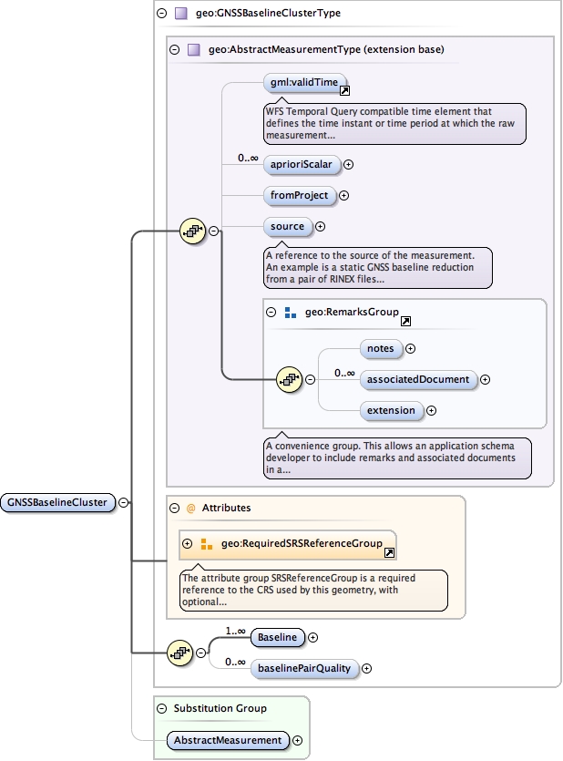
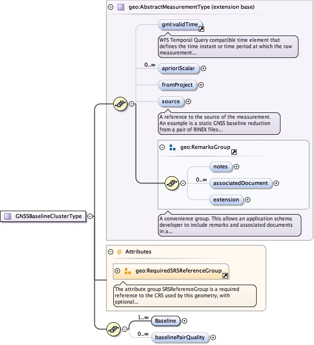
Element geo:GNSSBaselineCluster
Namespace urn:xml-gov-au:icsm:egeodesy:0.4
Diagram
Type geo:GNSSBaselineClusterType
Type hierarchy
Properties
Substitution Group Affiliation
Model
validTime{0,1} ,
geo:aprioriScalar* ,
geo:fromProject{0,1} ,
geo:source{0,1} ,
geo:notes{0,1} ,
geo:associatedDocument* ,
geo:extension{0,1} ,
geo:Baseline+ ,
geo:baselinePairQuality*
Children geo:Baseline geo:aprioriScalar geo:associatedDocument geo:baselinePairQuality geo:extension geo:fromProject geo:notes geo:source validTime
Instance
<geo:GNSSBaselineCluster srsDimension= "" srsName= "" xmlns:geo= "urn:xml-gov-au:icsm:egeodesy:0.4" >
<validTime > {0,1} </validTime>
<geo:aprioriScalar axisLabels= "" codeSpace= "" confidence= "" uomLabels= "" > {0,unbounded} </geo:aprioriScalar>
<geo:fromProject > {0,1} </geo:fromProject>
<geo:source > {0,1} </geo:source>
<geo:notes > {0,1} </geo:notes>
<geo:associatedDocument > {0,unbounded} </geo:associatedDocument>
<geo:extension > {0,1} </geo:extension>
<geo:Baseline > {1,unbounded} </geo:Baseline>
<geo:baselinePairQuality > {0,unbounded} </geo:baselinePairQuality>
</geo:GNSSBaselineCluster>
Attributes
Source
<element name= "GNSSBaselineCluster" substitutionGroup= "geo:AbstractMeasurement" type= "geo:GNSSBaselineClusterType" />
Schema location file:/Users/boss/dev/GeodesyML/schemas/measurement.xsd
Namespace urn:xml-gov-au:icsm:egeodesy:0.4
Diagram
Type geo:MeasurementLineType
Type hierarchy
Properties
content
complex
maxOccurs
unbounded
Model
geo:atSetup{0,1} ,
geo:toSetup{0,1} ,
geo:atNode ,
geo:atHeight{0,1} ,
geo:toNode ,
geo:toHeight{0,1} ,
geo:value ,
geo:AbstractQuality* ,
geo:notes{0,1} ,
geo:associatedDocument* ,
geo:extension{0,1}
Children geo:AbstractQuality geo:associatedDocument geo:atHeight geo:atNode geo:atSetup geo:extension geo:notes geo:toHeight geo:toNode geo:toSetup geo:value
Instance
<geo:Baseline xmlns:geo= "urn:xml-gov-au:icsm:egeodesy:0.4" >
<geo:atSetup > {0,1} </geo:atSetup>
<geo:toSetup > {0,1} </geo:toSetup>
<geo:atNode > {1,1} </geo:atNode>
<geo:atHeight > {0,1} </geo:atHeight>
<geo:toNode > {1,1} </geo:toNode>
<geo:toHeight > {0,1} </geo:toHeight>
<geo:value > {1,1} </geo:value>
<geo:AbstractQuality > {0,unbounded} </geo:AbstractQuality>
<geo:notes > {0,1} </geo:notes>
<geo:associatedDocument > {0,unbounded} </geo:associatedDocument>
<geo:extension > {0,1} </geo:extension>
</geo:Baseline>
Source
<element maxOccurs= "unbounded" name= "Baseline" type= "geo:MeasurementLineType" />
Schema location file:/Users/boss/dev/GeodesyML/schemas/measurement.xsd
Namespace urn:xml-gov-au:icsm:egeodesy:0.4
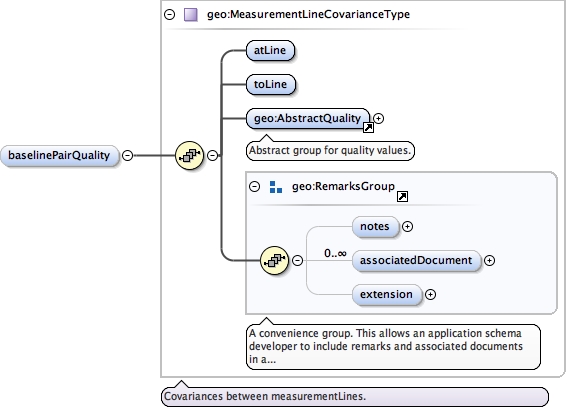
Diagram
Type geo:MeasurementLineCovarianceType
Type hierarchy
Properties
content
complex
minOccurs
0
maxOccurs
unbounded
Model
Children geo:AbstractQuality geo:associatedDocument geo:atLine geo:extension geo:notes geo:toLine
Instance
<geo:baselinePairQuality xmlns:geo= "urn:xml-gov-au:icsm:egeodesy:0.4" >
<geo:atLine > {1,1} </geo:atLine>
<geo:toLine > {1,1} </geo:toLine>
<geo:AbstractQuality > {1,1} </geo:AbstractQuality>
<geo:notes > {0,1} </geo:notes>
<geo:associatedDocument > {0,unbounded} </geo:associatedDocument>
<geo:extension > {0,1} </geo:extension>
</geo:baselinePairQuality>
Source
<element maxOccurs= "unbounded" minOccurs= "0" name= "baselinePairQuality" type= "geo:MeasurementLineCovarianceType" />
Schema location file:/Users/boss/dev/GeodesyML/schemas/measurement.xsd
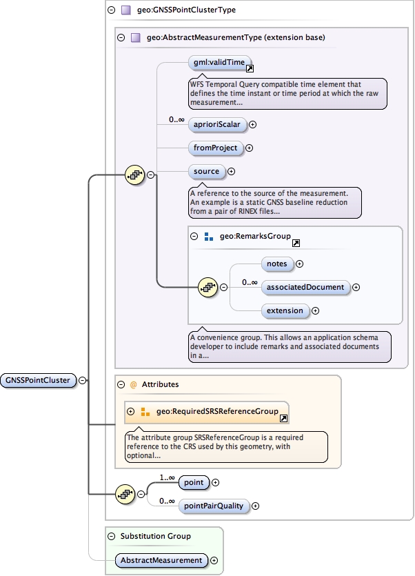
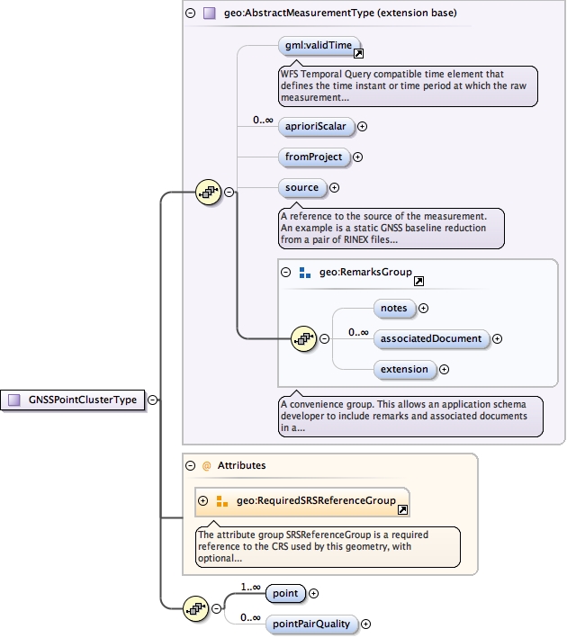
Element geo:GNSSPointCluster
Namespace urn:xml-gov-au:icsm:egeodesy:0.4
Diagram
Type geo:GNSSPointClusterType
Type hierarchy
Properties
Substitution Group Affiliation
Model
validTime{0,1} ,
geo:aprioriScalar* ,
geo:fromProject{0,1} ,
geo:source{0,1} ,
geo:notes{0,1} ,
geo:associatedDocument* ,
geo:extension{0,1} ,
geo:point+ ,
geo:pointPairQuality*
Children geo:aprioriScalar geo:associatedDocument geo:extension geo:fromProject geo:notes geo:point geo:pointPairQuality geo:source validTime
Instance
<geo:GNSSPointCluster srsDimension= "" srsName= "" xmlns:geo= "urn:xml-gov-au:icsm:egeodesy:0.4" >
<validTime > {0,1} </validTime>
<geo:aprioriScalar axisLabels= "" codeSpace= "" confidence= "" uomLabels= "" > {0,unbounded} </geo:aprioriScalar>
<geo:fromProject > {0,1} </geo:fromProject>
<geo:source > {0,1} </geo:source>
<geo:notes > {0,1} </geo:notes>
<geo:associatedDocument > {0,unbounded} </geo:associatedDocument>
<geo:extension > {0,1} </geo:extension>
<geo:point > {1,unbounded} </geo:point>
<geo:pointPairQuality > {0,unbounded} </geo:pointPairQuality>
</geo:GNSSPointCluster>
Attributes
Source
<element name= "GNSSPointCluster" substitutionGroup= "geo:AbstractMeasurement" type= "geo:GNSSPointClusterType" />
Schema location file:/Users/boss/dev/GeodesyML/schemas/measurement.xsd
Namespace urn:xml-gov-au:icsm:egeodesy:0.4
Diagram
Type geo:MeasurementPointType
Type hierarchy
Properties
content
complex
maxOccurs
unbounded
Model
geo:atSetup ,
geo:atNode ,
geo:atHeight{0,1} ,
geo:value ,
geo:AbstractQuality* ,
geo:notes{0,1} ,
geo:associatedDocument* ,
geo:extension{0,1}
Children geo:AbstractQuality geo:associatedDocument geo:atHeight geo:atNode geo:atSetup geo:extension geo:notes geo:value
Instance
<geo:point xmlns:geo= "urn:xml-gov-au:icsm:egeodesy:0.4" >
<geo:atSetup > {1,1} </geo:atSetup>
<geo:atNode > {1,1} </geo:atNode>
<geo:atHeight > {0,1} </geo:atHeight>
<geo:value uomLabel= "" > {1,1} </geo:value>
<geo:AbstractQuality > {0,unbounded} </geo:AbstractQuality>
<geo:notes > {0,1} </geo:notes>
<geo:associatedDocument > {0,unbounded} </geo:associatedDocument>
<geo:extension > {0,1} </geo:extension>
</geo:point>
Source
<element maxOccurs= "unbounded" name= "point" type= "geo:MeasurementPointType" />
Schema location file:/Users/boss/dev/GeodesyML/schemas/measurement.xsd
Namespace urn:xml-gov-au:icsm:egeodesy:0.4
Diagram
Type geo:MeasurementPointCovarianceType
Type hierarchy
Properties
content
complex
minOccurs
0
maxOccurs
unbounded
Model
Children geo:AbstractQuality geo:associatedDocument geo:atPoint geo:extension geo:notes geo:toPoint
Instance
<geo:pointPairQuality xmlns:geo= "urn:xml-gov-au:icsm:egeodesy:0.4" >
<geo:atPoint > {1,1} </geo:atPoint>
<geo:toPoint > {1,1} </geo:toPoint>
<geo:AbstractQuality > {1,1} </geo:AbstractQuality>
<geo:notes > {0,1} </geo:notes>
<geo:associatedDocument > {0,unbounded} </geo:associatedDocument>
<geo:extension > {0,1} </geo:extension>
</geo:pointPairQuality>
Source
<element maxOccurs= "unbounded" minOccurs= "0" name= "pointPairQuality" type= "geo:MeasurementPointCovarianceType" />
Schema location file:/Users/boss/dev/GeodesyML/schemas/measurement.xsd
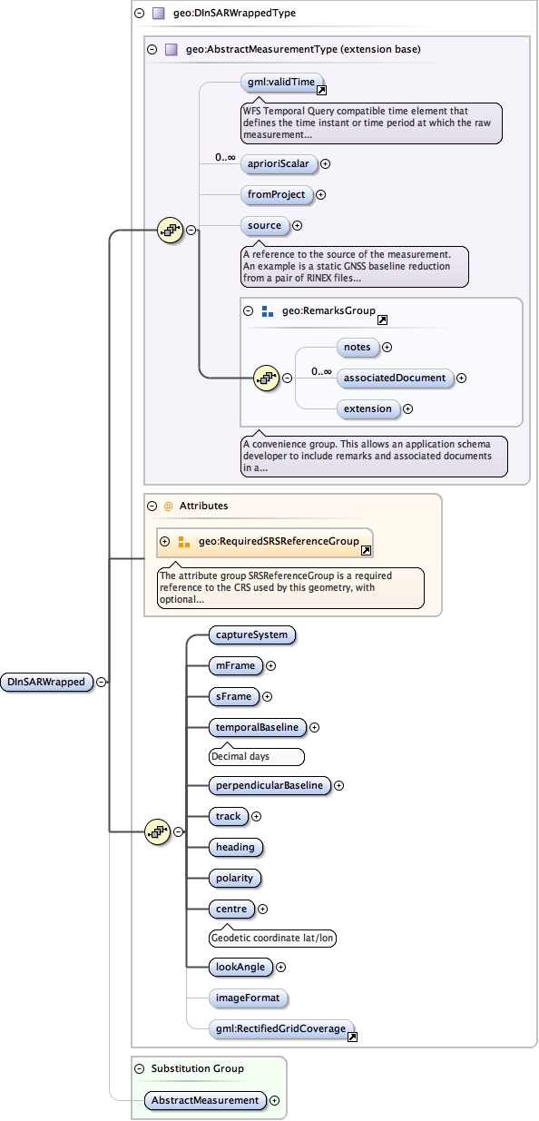
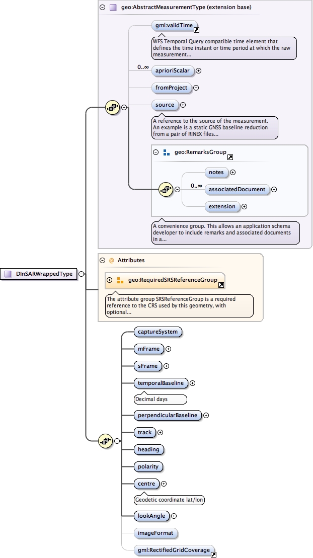
Element geo:DInSARWrapped
Namespace urn:xml-gov-au:icsm:egeodesy:0.4
Diagram
Type geo:DInSARWrappedType
Type hierarchy
Properties
Substitution Group Affiliation
Model
validTime{0,1} ,
geo:aprioriScalar* ,
geo:fromProject{0,1} ,
geo:source{0,1} ,
geo:notes{0,1} ,
geo:associatedDocument* ,
geo:extension{0,1} ,
geo:captureSystem ,
geo:mFrame ,
geo:sFrame ,
geo:temporalBaseline ,
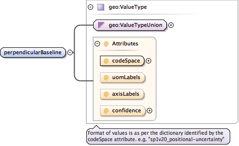
geo:perpendicularBaseline ,
geo:track ,
geo:heading ,
geo:polarity ,
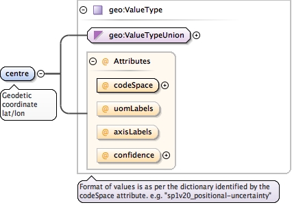
geo:centre ,
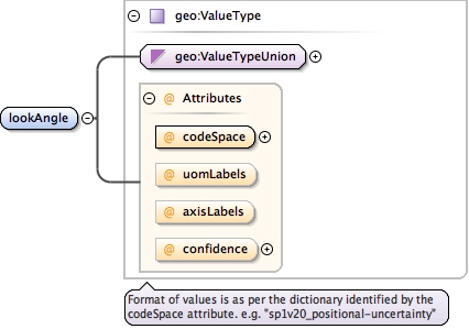
geo:lookAngle ,
geo:imageFormat{0,1} ,
RectifiedGridCoverage{0,1}
Children RectifiedGridCoverage , geo:aprioriScalar geo:associatedDocument geo:captureSystem geo:centre geo:extension geo:fromProject geo:heading geo:imageFormat geo:lookAngle geo:mFrame geo:notes geo:perpendicularBaseline geo:polarity geo:sFrame geo:source geo:temporalBaseline geo:track validTime
Instance
<geo:DInSARWrapped srsDimension= "" srsName= "" xmlns:geo= "urn:xml-gov-au:icsm:egeodesy:0.4" >
<validTime > {0,1} </validTime>
<geo:aprioriScalar axisLabels= "" codeSpace= "" confidence= "" uomLabels= "" > {0,unbounded} </geo:aprioriScalar>
<geo:fromProject > {0,1} </geo:fromProject>
<geo:source > {0,1} </geo:source>
<geo:notes > {0,1} </geo:notes>
<geo:associatedDocument > {0,unbounded} </geo:associatedDocument>
<geo:extension > {0,1} </geo:extension>
<geo:captureSystem > {1,1} </geo:captureSystem>
<geo:mFrame > {1,1} </geo:mFrame>
<geo:sFrame > {1,1} </geo:sFrame>
<geo:temporalBaseline > {1,1} </geo:temporalBaseline>
<geo:perpendicularBaseline axisLabels= "" codeSpace= "" confidence= "" uomLabels= "" > {1,1} </geo:perpendicularBaseline>
<geo:track > {1,1} </geo:track>
<geo:heading > {1,1} </geo:heading>
<geo:polarity > {1,1} </geo:polarity>
<geo:centre axisLabels= "" codeSpace= "" confidence= "" uomLabels= "" > {1,1} </geo:centre>
<geo:lookAngle axisLabels= "" codeSpace= "" confidence= "" uomLabels= "" > {1,1} </geo:lookAngle>
<geo:imageFormat > {0,1} </geo:imageFormat>
<RectifiedGridCoverage > {0,1} </RectifiedGridCoverage>
</geo:DInSARWrapped>
Attributes
Source
<element name= "DInSARWrapped" substitutionGroup= "geo:AbstractMeasurement" type= "geo:DInSARWrappedType" />
Schema location file:/Users/boss/dev/GeodesyML/schemas/measurement.xsd
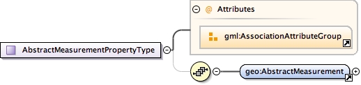
Complex Type geo:AbstractMeasurementPropertyType
Complex Type geo:AbstractMeasurementType
Namespace urn:xml-gov-au:icsm:egeodesy:0.4
Diagram
Type extension of AbstractFeatureType
Type hierarchy
Used by
Complex Types
geo:AstronomicAzimuthType geo:AstronomicLatitudeType geo:AstronomicLongitudeType geo:DInSARWrappedType geo:DirectionSetType geo:EllipsoidChordDistanceType geo:EllipsoidHeightType geo:GNSSBaselineClusterType geo:GNSSBaselineType geo:GNSSPointClusterType geo:GeodeticAzimuthType geo:HeightDifferenceType geo:HorizontalAngleType geo:MeanSeaLevelArcDistanceType geo:MeasurementType geo:OrthometricHeightDifferenceType geo:OrthometricHeightType geo:SlopeDistanceType geo:TieMeasurementType geo:VerticalAngleType geo:ZenithDistanceType
Model
validTime{0,1} ,
geo:aprioriScalar* ,
geo:fromProject{0,1} ,
geo:source{0,1} ,
geo:notes{0,1} ,
geo:associatedDocument* ,
geo:extension{0,1}
Children geo:aprioriScalar geo:associatedDocument geo:extension geo:fromProject geo:notes geo:source validTime
Source
<complexType name= "AbstractMeasurementType" >
<complexContent >
<extension base= "gml:AbstractFeatureType" >
<sequence >
<element minOccurs= "0" ref= "gml:validTime" >
<annotation >
<documentation > WFS Temporal Query compatible time element that defines the time instant or time period at which the raw measurement was observed in the field. </documentation>
</annotation>
</element>
<element maxOccurs= "unbounded" minOccurs= "0" name= "aprioriScalar" type= "geo:ValueType" />
<element minOccurs= "0" name= "fromProject" type= "geo:ProjectPropertyType" />
<element minOccurs= "0" name= "source" type= "geo:AbstractMeasurementSourcePropertyType" >
<annotation >
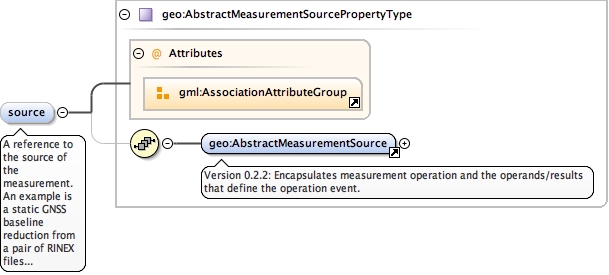
<documentation > A reference to the source of the measurement. An example is a static GNSS baseline reduction from a pair of RINEX files via baseline processing software. Another example is atmospheric correction of a raw EDM measurement. Optional. </documentation>
</annotation>
</element>
<group ref= "geo:RemarksGroup" />
</sequence>
</extension>
</complexContent>
</complexType>
Schema location file:/Users/boss/dev/GeodesyML/schemas/measurement.xsd
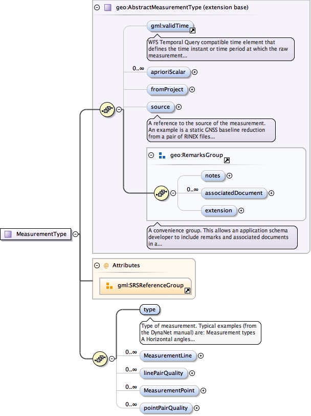
Complex Type geo:MeasurementType
Namespace urn:xml-gov-au:icsm:egeodesy:0.4
Diagram
Type extension of geo:AbstractMeasurementType
Type hierarchy
Used by
Model
validTime{0,1} ,
geo:aprioriScalar* ,
geo:fromProject{0,1} ,
geo:source{0,1} ,
geo:notes{0,1} ,
geo:associatedDocument* ,
geo:extension{0,1} ,
geo:type ,
geo:MeasurementLine* ,
geo:linePairQuality* ,
geo:MeasurementPoint* ,
geo:pointPairQuality*
Children geo:MeasurementLine geo:MeasurementPoint geo:aprioriScalar geo:associatedDocument geo:extension geo:fromProject geo:linePairQuality geo:notes geo:pointPairQuality geo:source geo:type validTime
Source
<complexType name= "MeasurementType" >
<complexContent >
<extension base= "geo:AbstractMeasurementType" >
<sequence >
<element name= "type" type= "gml:CodeType" >
<annotation >
<documentation > Type of measurement. Typical examples (from the DynaNet manual) are: Measurement types A Horizontal angles (uncorrelated) B Geodetic azimuth (or bearing) C Ellipsoid chord distance D Direction set E Ellipsoid arc distance G Single GNSS baseline H Orthometric height I Astronomic latitude J Astronomic longitude K Astronomic (Laplace) azimuth L Orthometric height difference M Mean sea level (MSL) arc distance P Geodetic latitude Q Geodetic longitude R Ellipsoid height S Slope (direct) distance V Zenith distance X GNSS baseline cluster (full correlations) Y GNSS point cluster (full correlations) Z Vertical angle </documentation>
</annotation>
</element>
<element maxOccurs= "unbounded" minOccurs= "0" name= "MeasurementLine" type= "geo:MeasurementLineType" />
<element maxOccurs= "unbounded" minOccurs= "0" name= "linePairQuality" type= "geo:MeasurementLineCovarianceType" />
<element maxOccurs= "unbounded" minOccurs= "0" name= "MeasurementPoint" type= "geo:MeasurementPointType" />
<element maxOccurs= "unbounded" minOccurs= "0" name= "pointPairQuality" type= "geo:MeasurementPointCovarianceType" />
</sequence>
<attributeGroup ref= "gml:SRSReferenceGroup" />
</extension>
</complexContent>
</complexType>
Schema location file:/Users/boss/dev/GeodesyML/schemas/measurement.xsd
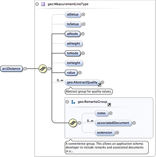
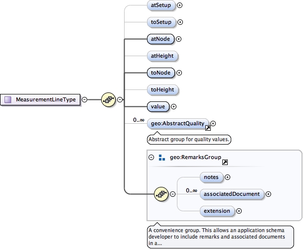
Complex Type geo:MeasurementLineType
Namespace urn:xml-gov-au:icsm:egeodesy:0.4
Diagram
Type extension of AbstractGMLType
Type hierarchy
Used by
Elements
geo:AstronomicAzimuthType/geo:azimuth geo:DirectionSetType/geo:direction geo:EllipsoidChordDistanceType/geo:distance geo:GNSSBaselineClusterType/geo:Baseline geo:GNSSBaselineType/geo:vector geo:GeodeticAzimuthType/geo:azimuth geo:HeightDifferenceType/geo:heightDifference geo:HorizontalAngleType/geo:angle geo:MeanSeaLevelArcDistanceType/geo:arcDistance geo:MeasurementType/geo:MeasurementLine geo:OrthometricHeightDifferenceType/geo:heightDifference geo:SlopeDistanceType/geo:slopeDistance geo:TieMeasurementType/geo:Tie geo:VerticalAngleType/geo:verticalAngle geo:ZenithDistanceType/geo:zenithDistance
Model
geo:atSetup{0,1} ,
geo:toSetup{0,1} ,
geo:atNode ,
geo:atHeight{0,1} ,
geo:toNode ,
geo:toHeight{0,1} ,
geo:value ,
geo:AbstractQuality* ,
geo:notes{0,1} ,
geo:associatedDocument* ,
geo:extension{0,1}
Children geo:AbstractQuality geo:associatedDocument geo:atHeight geo:atNode geo:atSetup geo:extension geo:notes geo:toHeight geo:toNode geo:toSetup geo:value
Source
<complexType name= "MeasurementLineType" >
<complexContent >
<extension base= "gml:AbstractGMLType" >
<sequence >
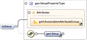
<element minOccurs= "0" name= "atSetup" type= "geo:SetupPropertyType" />
<element minOccurs= "0" name= "toSetup" type= "geo:SetupPropertyType" />
<element name= "atNode" type= "geo:NodePropertyType" />
<element minOccurs= "0" name= "atHeight" type= "gml:MeasureType" />
<element name= "toNode" type= "geo:NodePropertyType" />
<element minOccurs= "0" name= "toHeight" type= "gml:MeasureType" />
<element name= "value" >
<complexType >
<simpleContent >
<extension base= "gml:doubleList" >
<attribute name= "uomLabels" type= "gml:NCNameList" />
</extension>
</simpleContent>
</complexType>
</element>
<element maxOccurs= "unbounded" minOccurs= "0" ref= "geo:AbstractQuality" />
<group ref= "geo:RemarksGroup" />
</sequence>
</extension>
</complexContent>
</complexType>
Schema location file:/Users/boss/dev/GeodesyML/schemas/measurement.xsd
Complex Type geo:MeasurementLineCovarianceType
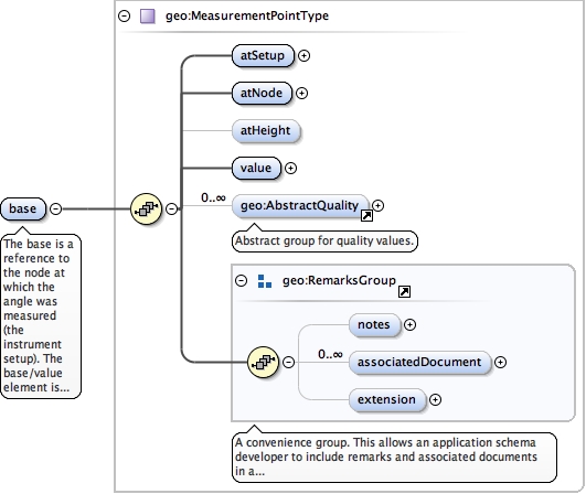
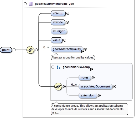
Complex Type geo:MeasurementPointType
Namespace urn:xml-gov-au:icsm:egeodesy:0.4
Diagram
Type extension of AbstractGMLType
Type hierarchy
Used by
Model
geo:atSetup ,
geo:atNode ,
geo:atHeight{0,1} ,
geo:value ,
geo:AbstractQuality* ,
geo:notes{0,1} ,
geo:associatedDocument* ,
geo:extension{0,1}
Children geo:AbstractQuality geo:associatedDocument geo:atHeight geo:atNode geo:atSetup geo:extension geo:notes geo:value
Source
<complexType name= "MeasurementPointType" >
<complexContent >
<extension base= "gml:AbstractGMLType" >
<sequence >
<element name= "atSetup" type= "geo:SetupPropertyType" />
<element name= "atNode" type= "geo:NodePropertyType" />
<element minOccurs= "0" name= "atHeight" type= "gml:MeasureType" />
<element name= "value" >
<complexType >
<simpleContent >
<extension base= "double" >
<attribute name= "uomLabel" type= "NCName" />
</extension>
</simpleContent>
</complexType>
</element>
<element maxOccurs= "unbounded" minOccurs= "0" ref= "geo:AbstractQuality" />
<group ref= "geo:RemarksGroup" />
</sequence>
</extension>
</complexContent>
</complexType>
Schema location file:/Users/boss/dev/GeodesyML/schemas/measurement.xsd
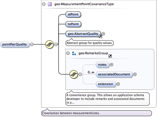
Complex Type geo:MeasurementPointCovarianceType
Complex Type geo:HorizontalAngleType
Namespace urn:xml-gov-au:icsm:egeodesy:0.4
Diagram
Type extension of geo:AbstractMeasurementType
Type hierarchy
Used by
Model
validTime{0,1} ,
geo:aprioriScalar* ,
geo:fromProject{0,1} ,
geo:source{0,1} ,
geo:notes{0,1} ,
geo:associatedDocument* ,
geo:extension{0,1} ,
geo:base ,
geo:angle
Children geo:angle geo:aprioriScalar geo:associatedDocument geo:base geo:extension geo:fromProject geo:notes geo:source validTime
Source
<complexType name= "HorizontalAngleType" >
<complexContent >
<extension base= "geo:AbstractMeasurementType" >
<sequence >
<element name= "base" type= "geo:MeasurementPointType" >
<annotation >
<documentation > The base is a reference to the node at which the angle was measured (the instrument setup). The base/value element is ignored and by convention should be blank. </documentation>
</annotation>
</element>
<element name= "angle" type= "geo:MeasurementLineType" />
</sequence>
</extension>
</complexContent>
</complexType>
Schema location file:/Users/boss/dev/GeodesyML/schemas/measurement.xsd
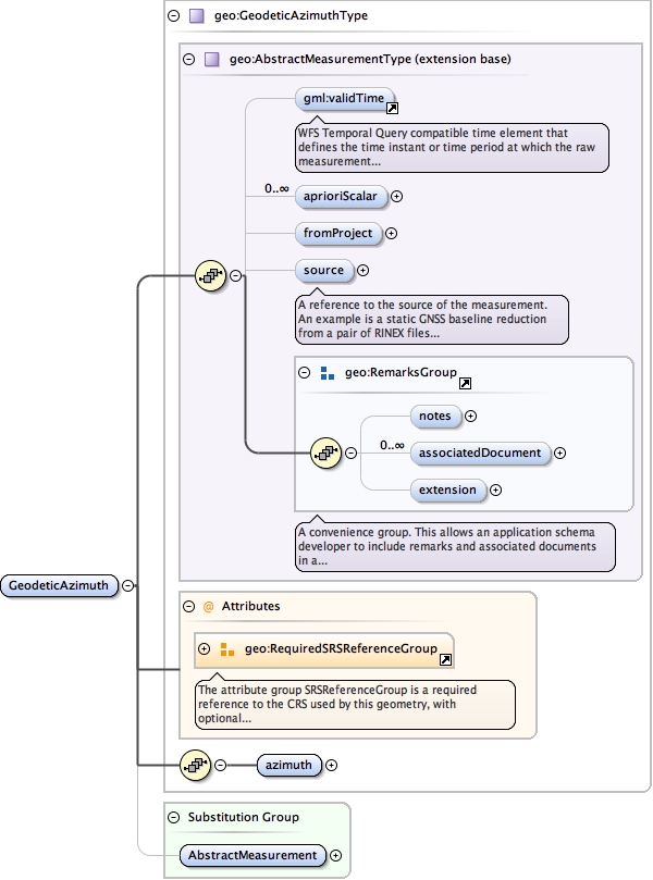
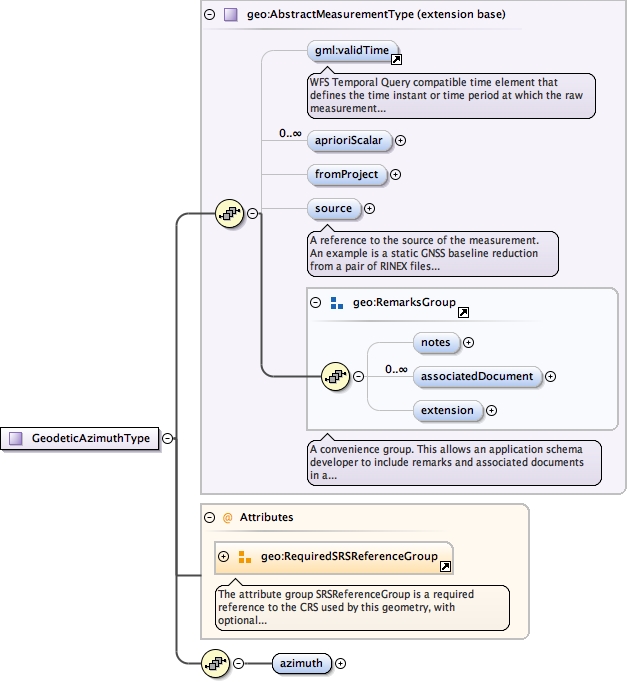
Complex Type geo:GeodeticAzimuthType
Namespace urn:xml-gov-au:icsm:egeodesy:0.4
Diagram
Type extension of geo:AbstractMeasurementType
Type hierarchy
Used by
Model
validTime{0,1} ,
geo:aprioriScalar* ,
geo:fromProject{0,1} ,
geo:source{0,1} ,
geo:notes{0,1} ,
geo:associatedDocument* ,
geo:extension{0,1} ,
geo:azimuth
Children geo:aprioriScalar geo:associatedDocument geo:azimuth geo:extension geo:fromProject geo:notes geo:source validTime
Attributes
Source
<complexType name= "GeodeticAzimuthType" >
<complexContent >
<extension base= "geo:AbstractMeasurementType" >
<sequence >
<element name= "azimuth" type= "geo:MeasurementLineType" />
</sequence>
<attributeGroup ref= "geo:RequiredSRSReferenceGroup" />
</extension>
</complexContent>
</complexType>
Schema location file:/Users/boss/dev/GeodesyML/schemas/measurement.xsd
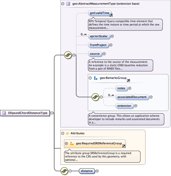
Complex Type geo:EllipsoidChordDistanceType
Namespace urn:xml-gov-au:icsm:egeodesy:0.4
Diagram
Type extension of geo:AbstractMeasurementType
Type hierarchy
Used by
Model
validTime{0,1} ,
geo:aprioriScalar* ,
geo:fromProject{0,1} ,
geo:source{0,1} ,
geo:notes{0,1} ,
geo:associatedDocument* ,
geo:extension{0,1} ,
geo:distance
Children geo:aprioriScalar geo:associatedDocument geo:distance geo:extension geo:fromProject geo:notes geo:source validTime
Attributes
Source
<complexType name= "EllipsoidChordDistanceType" >
<complexContent >
<extension base= "geo:AbstractMeasurementType" >
<sequence >
<element name= "distance" type= "geo:MeasurementLineType" />
</sequence>
<attributeGroup ref= "geo:RequiredSRSReferenceGroup" />
</extension>
</complexContent>
</complexType>
Schema location file:/Users/boss/dev/GeodesyML/schemas/measurement.xsd
Complex Type geo:EllipsoidArcDistanceType
Namespace urn:xml-gov-au:icsm:egeodesy:0.4
Annotations
Ellipsoid Arc Distances store the same data structure as Ellipsoid Chord Distances and differ only in implementation, thus it is safe to use an alias.
Diagram
Type extension of geo:EllipsoidChordDistanceType
Type hierarchy
Used by
Model
validTime{0,1} ,
geo:aprioriScalar* ,
geo:fromProject{0,1} ,
geo:source{0,1} ,
geo:notes{0,1} ,
geo:associatedDocument* ,
geo:extension{0,1} ,
geo:distance
Children geo:aprioriScalar geo:associatedDocument geo:distance geo:extension geo:fromProject geo:notes geo:source validTime
Attributes
Source
<complexType name= "EllipsoidArcDistanceType" >
<annotation >
<documentation > Ellipsoid Arc Distances store the same data structure as Ellipsoid Chord Distances and differ only in implementation, thus it is safe to use an alias. </documentation>
</annotation>
<complexContent >
<extension base= "geo:EllipsoidChordDistanceType" />
</complexContent>
</complexType>
Schema location file:/Users/boss/dev/GeodesyML/schemas/measurement.xsd
Complex Type geo:DirectionSetType
Namespace urn:xml-gov-au:icsm:egeodesy:0.4
Diagram
Type extension of geo:AbstractMeasurementType
Type hierarchy
Used by
Model
validTime{0,1} ,
geo:aprioriScalar* ,
geo:fromProject{0,1} ,
geo:source{0,1} ,
geo:notes{0,1} ,
geo:associatedDocument* ,
geo:extension{0,1} ,
geo:direction+ ,
geo:directionPairQuality*
Children geo:aprioriScalar geo:associatedDocument geo:direction geo:directionPairQuality geo:extension geo:fromProject geo:notes geo:source validTime
Source
<complexType name= "DirectionSetType" >
<complexContent >
<extension base= "geo:AbstractMeasurementType" >
<sequence >
<element maxOccurs= "unbounded" name= "direction" type= "geo:MeasurementLineType" />
<element maxOccurs= "unbounded" minOccurs= "0" name= "directionPairQuality" type= "geo:MeasurementLineCovarianceType" />
</sequence>
</extension>
</complexContent>
</complexType>
Schema location file:/Users/boss/dev/GeodesyML/schemas/measurement.xsd
Complex Type geo:GNSSBaselineType
Namespace urn:xml-gov-au:icsm:egeodesy:0.4
Diagram
Type extension of geo:AbstractMeasurementType
Type hierarchy
Used by
Model
validTime{0,1} ,
geo:aprioriScalar* ,
geo:fromProject{0,1} ,
geo:source{0,1} ,
geo:notes{0,1} ,
geo:associatedDocument* ,
geo:extension{0,1} ,
geo:vector
Children geo:aprioriScalar geo:associatedDocument geo:extension geo:fromProject geo:notes geo:source geo:vector validTime
Attributes
Source
<complexType name= "GNSSBaselineType" >
<complexContent >
<extension base= "geo:AbstractMeasurementType" >
<sequence >
<element name= "vector" type= "geo:MeasurementLineType" />
</sequence>
<attributeGroup ref= "geo:RequiredSRSReferenceGroup" />
</extension>
</complexContent>
</complexType>
Schema location file:/Users/boss/dev/GeodesyML/schemas/measurement.xsd
Complex Type geo:OrthometricHeightType
Namespace urn:xml-gov-au:icsm:egeodesy:0.4
Diagram
Type extension of geo:AbstractMeasurementType
Type hierarchy
Used by
Model
validTime{0,1} ,
geo:aprioriScalar* ,
geo:fromProject{0,1} ,
geo:source{0,1} ,
geo:notes{0,1} ,
geo:associatedDocument* ,
geo:extension{0,1} ,
geo:orthometricHeight
Children geo:aprioriScalar geo:associatedDocument geo:extension geo:fromProject geo:notes geo:orthometricHeight geo:source validTime
Attributes
Source
<complexType name= "OrthometricHeightType" >
<complexContent >
<extension base= "geo:AbstractMeasurementType" >
<sequence >
<element name= "orthometricHeight" type= "geo:MeasurementPointType" />
</sequence>
<attributeGroup ref= "geo:RequiredSRSReferenceGroup" />
</extension>
</complexContent>
</complexType>
Schema location file:/Users/boss/dev/GeodesyML/schemas/measurement.xsd
Complex Type geo:HeightDifferenceType
Namespace urn:xml-gov-au:icsm:egeodesy:0.4
Diagram
Type extension of geo:AbstractMeasurementType
Type hierarchy
Used by
Model
validTime{0,1} ,
geo:aprioriScalar* ,
geo:fromProject{0,1} ,
geo:source{0,1} ,
geo:notes{0,1} ,
geo:associatedDocument* ,
geo:extension{0,1} ,
geo:heightDifference
Children geo:aprioriScalar geo:associatedDocument geo:extension geo:fromProject geo:heightDifference geo:notes geo:source validTime
Source
<complexType name= "HeightDifferenceType" >
<complexContent >
<extension base= "geo:AbstractMeasurementType" >
<sequence >
<element name= "heightDifference" type= "geo:MeasurementLineType" />
</sequence>
</extension>
</complexContent>
</complexType>
Schema location file:/Users/boss/dev/GeodesyML/schemas/measurement.xsd
Complex Type geo:OrthometricHeightDifferenceType
Namespace urn:xml-gov-au:icsm:egeodesy:0.4
Diagram
Type extension of geo:AbstractMeasurementType
Type hierarchy
Used by
Model
validTime{0,1} ,
geo:aprioriScalar* ,
geo:fromProject{0,1} ,
geo:source{0,1} ,
geo:notes{0,1} ,
geo:associatedDocument* ,
geo:extension{0,1} ,
geo:heightDifference
Children geo:aprioriScalar geo:associatedDocument geo:extension geo:fromProject geo:heightDifference geo:notes geo:source validTime
Attributes
Source
<complexType name= "OrthometricHeightDifferenceType" >
<complexContent >
<extension base= "geo:AbstractMeasurementType" >
<sequence >
<element name= "heightDifference" type= "geo:MeasurementLineType" />
</sequence>
<attributeGroup ref= "geo:RequiredSRSReferenceGroup" />
</extension>
</complexContent>
</complexType>
Schema location file:/Users/boss/dev/GeodesyML/schemas/measurement.xsd
Complex Type geo:AstronomicLatitudeType
Namespace urn:xml-gov-au:icsm:egeodesy:0.4
Diagram
Type extension of geo:AbstractMeasurementType
Type hierarchy
Used by
Model
validTime{0,1} ,
geo:aprioriScalar* ,
geo:fromProject{0,1} ,
geo:source{0,1} ,
geo:notes{0,1} ,
geo:associatedDocument* ,
geo:extension{0,1} ,
geo:latitude
Children geo:aprioriScalar geo:associatedDocument geo:extension geo:fromProject geo:latitude geo:notes geo:source validTime
Attributes
Source
<complexType name= "AstronomicLatitudeType" >
<complexContent >
<extension base= "geo:AbstractMeasurementType" >
<sequence >
<element name= "latitude" type= "geo:MeasurementPointType" />
</sequence>
<attributeGroup ref= "geo:RequiredSRSReferenceGroup" />
</extension>
</complexContent>
</complexType>
Schema location file:/Users/boss/dev/GeodesyML/schemas/measurement.xsd
Complex Type geo:AstronomicLongitudeType
Namespace urn:xml-gov-au:icsm:egeodesy:0.4
Diagram
Type extension of geo:AbstractMeasurementType
Type hierarchy
Used by
Model
validTime{0,1} ,
geo:aprioriScalar* ,
geo:fromProject{0,1} ,
geo:source{0,1} ,
geo:notes{0,1} ,
geo:associatedDocument* ,
geo:extension{0,1} ,
geo:longitude
Children geo:aprioriScalar geo:associatedDocument geo:extension geo:fromProject geo:longitude geo:notes geo:source validTime
Attributes
Source
<complexType name= "AstronomicLongitudeType" >
<complexContent >
<extension base= "geo:AbstractMeasurementType" >
<sequence >
<element name= "longitude" type= "geo:MeasurementPointType" />
</sequence>
<attributeGroup ref= "geo:RequiredSRSReferenceGroup" />
</extension>
</complexContent>
</complexType>
Schema location file:/Users/boss/dev/GeodesyML/schemas/measurement.xsd
Complex Type geo:AstronomicAzimuthType
Namespace urn:xml-gov-au:icsm:egeodesy:0.4
Diagram
Type extension of geo:AbstractMeasurementType
Type hierarchy
Used by
Model
validTime{0,1} ,
geo:aprioriScalar* ,
geo:fromProject{0,1} ,
geo:source{0,1} ,
geo:notes{0,1} ,
geo:associatedDocument* ,
geo:extension{0,1} ,
geo:azimuth
Children geo:aprioriScalar geo:associatedDocument geo:azimuth geo:extension geo:fromProject geo:notes geo:source validTime
Attributes
Source
<complexType name= "AstronomicAzimuthType" >
<complexContent >
<extension base= "geo:AbstractMeasurementType" >
<sequence >
<element name= "azimuth" type= "geo:MeasurementLineType" />
</sequence>
<attributeGroup ref= "geo:RequiredSRSReferenceGroup" />
</extension>
</complexContent>
</complexType>
Schema location file:/Users/boss/dev/GeodesyML/schemas/measurement.xsd
Complex Type geo:GeodeticLatitudeType
Namespace urn:xml-gov-au:icsm:egeodesy:0.4
Diagram
Type extension of geo:AstronomicLatitudeType
Type hierarchy
Used by
Model
validTime{0,1} ,
geo:aprioriScalar* ,
geo:fromProject{0,1} ,
geo:source{0,1} ,
geo:notes{0,1} ,
geo:associatedDocument* ,
geo:extension{0,1} ,
geo:latitude
Children geo:aprioriScalar geo:associatedDocument geo:extension geo:fromProject geo:latitude geo:notes geo:source validTime
Attributes
Source
<complexType name= "GeodeticLatitudeType" >
<complexContent >
<extension base= "geo:AstronomicLatitudeType" />
</complexContent>
</complexType>
Schema location file:/Users/boss/dev/GeodesyML/schemas/measurement.xsd
Complex Type geo:GeodeticLongitudeType
Namespace urn:xml-gov-au:icsm:egeodesy:0.4
Diagram
Type extension of geo:AstronomicLongitudeType
Type hierarchy
Used by
Model
validTime{0,1} ,
geo:aprioriScalar* ,
geo:fromProject{0,1} ,
geo:source{0,1} ,
geo:notes{0,1} ,
geo:associatedDocument* ,
geo:extension{0,1} ,
geo:longitude
Children geo:aprioriScalar geo:associatedDocument geo:extension geo:fromProject geo:longitude geo:notes geo:source validTime
Attributes
Source
<complexType name= "GeodeticLongitudeType" >
<complexContent >
<extension base= "geo:AstronomicLongitudeType" />
</complexContent>
</complexType>
Schema location file:/Users/boss/dev/GeodesyML/schemas/measurement.xsd
Complex Type geo:MeanSeaLevelArcDistanceType
Namespace urn:xml-gov-au:icsm:egeodesy:0.4
Diagram
Type extension of geo:AbstractMeasurementType
Type hierarchy
Used by
Model
validTime{0,1} ,
geo:aprioriScalar* ,
geo:fromProject{0,1} ,
geo:source{0,1} ,
geo:notes{0,1} ,
geo:associatedDocument* ,
geo:extension{0,1} ,
geo:arcDistance
Children geo:aprioriScalar geo:arcDistance geo:associatedDocument geo:extension geo:fromProject geo:notes geo:source validTime
Attributes
Source
<complexType name= "MeanSeaLevelArcDistanceType" >
<complexContent >
<extension base= "geo:AbstractMeasurementType" >
<sequence >
<element name= "arcDistance" type= "geo:MeasurementLineType" />
</sequence>
<attributeGroup ref= "geo:RequiredSRSReferenceGroup" />
</extension>
</complexContent>
</complexType>
Schema location file:/Users/boss/dev/GeodesyML/schemas/measurement.xsd
Complex Type geo:SlopeDistanceType
Namespace urn:xml-gov-au:icsm:egeodesy:0.4
Diagram
Type extension of geo:AbstractMeasurementType
Type hierarchy
Used by
Model
validTime{0,1} ,
geo:aprioriScalar* ,
geo:fromProject{0,1} ,
geo:source{0,1} ,
geo:notes{0,1} ,
geo:associatedDocument* ,
geo:extension{0,1} ,
geo:slopeDistance
Children geo:aprioriScalar geo:associatedDocument geo:extension geo:fromProject geo:notes geo:slopeDistance geo:source validTime
Source
<complexType name= "SlopeDistanceType" >
<complexContent >
<extension base= "geo:AbstractMeasurementType" >
<sequence >
<element name= "slopeDistance" type= "geo:MeasurementLineType" />
</sequence>
</extension>
</complexContent>
</complexType>
Schema location file:/Users/boss/dev/GeodesyML/schemas/measurement.xsd
Complex Type geo:EllipsoidHeightType
Namespace urn:xml-gov-au:icsm:egeodesy:0.4
Diagram
Type extension of geo:AbstractMeasurementType
Type hierarchy
Used by
Model
validTime{0,1} ,
geo:aprioriScalar* ,
geo:fromProject{0,1} ,
geo:source{0,1} ,
geo:notes{0,1} ,
geo:associatedDocument* ,
geo:extension{0,1} ,
geo:ellipsoidHeight
Children geo:aprioriScalar geo:associatedDocument geo:ellipsoidHeight geo:extension geo:fromProject geo:notes geo:source validTime
Attributes
Source
<complexType name= "EllipsoidHeightType" >
<complexContent >
<extension base= "geo:AbstractMeasurementType" >
<sequence >
<element name= "ellipsoidHeight" type= "geo:MeasurementPointType" />
</sequence>
<attributeGroup ref= "geo:RequiredSRSReferenceGroup" />
</extension>
</complexContent>
</complexType>
Schema location file:/Users/boss/dev/GeodesyML/schemas/measurement.xsd
Complex Type geo:ZenithDistanceType
Namespace urn:xml-gov-au:icsm:egeodesy:0.4
Diagram
Type extension of geo:AbstractMeasurementType
Type hierarchy
Used by
Model
validTime{0,1} ,
geo:aprioriScalar* ,
geo:fromProject{0,1} ,
geo:source{0,1} ,
geo:notes{0,1} ,
geo:associatedDocument* ,
geo:extension{0,1} ,
geo:zenithDistance
Children geo:aprioriScalar geo:associatedDocument geo:extension geo:fromProject geo:notes geo:source geo:zenithDistance validTime
Source
<complexType name= "ZenithDistanceType" >
<complexContent >
<extension base= "geo:AbstractMeasurementType" >
<sequence >
<element name= "zenithDistance" type= "geo:MeasurementLineType" />
</sequence>
</extension>
</complexContent>
</complexType>
Schema location file:/Users/boss/dev/GeodesyML/schemas/measurement.xsd
Complex Type geo:VerticalAngleType
Namespace urn:xml-gov-au:icsm:egeodesy:0.4
Diagram
Type extension of geo:AbstractMeasurementType
Type hierarchy
Used by
Model
validTime{0,1} ,
geo:aprioriScalar* ,
geo:fromProject{0,1} ,
geo:source{0,1} ,
geo:notes{0,1} ,
geo:associatedDocument* ,
geo:extension{0,1} ,
geo:verticalAngle
Children geo:aprioriScalar geo:associatedDocument geo:extension geo:fromProject geo:notes geo:source geo:verticalAngle validTime
Source
<complexType name= "VerticalAngleType" >
<complexContent >
<extension base= "geo:AbstractMeasurementType" >
<sequence >
<element name= "verticalAngle" type= "geo:MeasurementLineType" />
</sequence>
</extension>
</complexContent>
</complexType>
Schema location file:/Users/boss/dev/GeodesyML/schemas/measurement.xsd
Complex Type geo:GNSSBaselineClusterType
Namespace urn:xml-gov-au:icsm:egeodesy:0.4
Diagram
Type extension of geo:AbstractMeasurementType
Type hierarchy
Used by
Model
validTime{0,1} ,
geo:aprioriScalar* ,
geo:fromProject{0,1} ,
geo:source{0,1} ,
geo:notes{0,1} ,
geo:associatedDocument* ,
geo:extension{0,1} ,
geo:Baseline+ ,
geo:baselinePairQuality*
Children geo:Baseline geo:aprioriScalar geo:associatedDocument geo:baselinePairQuality geo:extension geo:fromProject geo:notes geo:source validTime
Attributes
Source
<complexType name= "GNSSBaselineClusterType" >
<complexContent >
<extension base= "geo:AbstractMeasurementType" >
<sequence >
<element maxOccurs= "unbounded" name= "Baseline" type= "geo:MeasurementLineType" />
<element maxOccurs= "unbounded" minOccurs= "0" name= "baselinePairQuality" type= "geo:MeasurementLineCovarianceType" />
</sequence>
<attributeGroup ref= "geo:RequiredSRSReferenceGroup" />
</extension>
</complexContent>
</complexType>
Schema location file:/Users/boss/dev/GeodesyML/schemas/measurement.xsd
Complex Type geo:GNSSPointClusterType
Namespace urn:xml-gov-au:icsm:egeodesy:0.4
Diagram
Type extension of geo:AbstractMeasurementType
Type hierarchy
Used by
Model
validTime{0,1} ,
geo:aprioriScalar* ,
geo:fromProject{0,1} ,
geo:source{0,1} ,
geo:notes{0,1} ,
geo:associatedDocument* ,
geo:extension{0,1} ,
geo:point+ ,
geo:pointPairQuality*
Children geo:aprioriScalar geo:associatedDocument geo:extension geo:fromProject geo:notes geo:point geo:pointPairQuality geo:source validTime
Attributes
Source
<complexType name= "GNSSPointClusterType" >
<complexContent >
<extension base= "geo:AbstractMeasurementType" >
<sequence >
<element maxOccurs= "unbounded" name= "point" type= "geo:MeasurementPointType" />
<element maxOccurs= "unbounded" minOccurs= "0" name= "pointPairQuality" type= "geo:MeasurementPointCovarianceType" />
</sequence>
<attributeGroup ref= "geo:RequiredSRSReferenceGroup" />
</extension>
</complexContent>
</complexType>
Schema location file:/Users/boss/dev/GeodesyML/schemas/measurement.xsd
Complex Type geo:DInSARWrappedType
Namespace urn:xml-gov-au:icsm:egeodesy:0.4
Diagram
Type extension of geo:AbstractMeasurementType
Type hierarchy
Used by
Model
validTime{0,1} ,
geo:aprioriScalar* ,
geo:fromProject{0,1} ,
geo:source{0,1} ,
geo:notes{0,1} ,
geo:associatedDocument* ,
geo:extension{0,1} ,
geo:captureSystem ,
geo:mFrame ,
geo:sFrame ,
geo:temporalBaseline ,
geo:perpendicularBaseline ,
geo:track ,
geo:heading ,
geo:polarity ,
geo:centre ,
geo:lookAngle ,
geo:imageFormat{0,1} ,
RectifiedGridCoverage{0,1}
Children RectifiedGridCoverage , geo:aprioriScalar geo:associatedDocument geo:captureSystem geo:centre geo:extension geo:fromProject geo:heading geo:imageFormat geo:lookAngle geo:mFrame geo:notes geo:perpendicularBaseline geo:polarity geo:sFrame geo:source geo:temporalBaseline geo:track validTime
Attributes
Source
<complexType name= "DInSARWrappedType" >
<complexContent >
<extension base= "geo:AbstractMeasurementType" >
<sequence >
<element name= "captureSystem" type= "gml:CodeType" />
<!-- the start date and end date are catered for in the gml:validTime element in geo:AbstractMeasurementType -->
<element name= "mFrame" type= "decimal" />
<element name= "sFrame" type= "decimal" />
<element name= "temporalBaseline" type= "decimal" >
<annotation >
<documentation > Decimal days </documentation>
</annotation>
</element>
<element name= "perpendicularBaseline" type= "geo:ValueType" />
<element name= "track" type= "integer" />
<element name= "heading" type= "gml:CodeType" />
<element name= "polarity" type= "gml:CodeType" />
<element name= "centre" type= "geo:ValueType" >
<annotation >
<documentation > Geodetic coordinate lat/lon </documentation>
</annotation>
</element>
<element name= "lookAngle" type= "geo:ValueType" />
<element minOccurs= "0" name= "imageFormat" type= "gml:CodeType" />
<element minOccurs= "0" ref= "gml:RectifiedGridCoverage" />
</sequence>
<attributeGroup ref= "geo:RequiredSRSReferenceGroup" />
</extension>
</complexContent>
</complexType>
Schema location file:/Users/boss/dev/GeodesyML/schemas/measurement.xsd