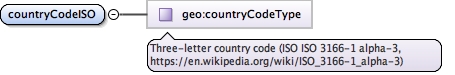
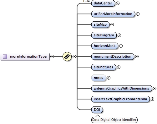
<p>Derived from SOPAC IGS Site Log XML Schema 2011</p><ul><li>http://sopac.ucsd.edu/ns/geodesy/doc/igsSiteLog/monumentInfo/2004/baseMonumentInfoLib.xsd</li><li>http://sopac.ucsd.edu/ns/geodesy/doc/igsSiteLog/monumentInfo/2004/formInformation.xsd</li><li>http://sopac.ucsd.edu/ns/geodesy/doc/igsSiteLog/monumentInfo/2004/monumentInfo.xsd</li><li>http://sopac.ucsd.edu/ns/geodesy/doc/igsSiteLog/monumentInfo/2004/moreInformation.xsd</li><li>http://sopac.ucsd.edu/ns/geodesy/doc/igsSiteLog/monumentInfo/2004/siteIdentification.xsd</li><li>http://sopac.ucsd.edu/ns/geodesy/doc/igsSiteLog/monumentInfo/2004/siteLocation.xsd</li></ul><p>Modifications from original</p><ul><li>Made part of eGeodesy namespace</li><li>Combined into single file</li><li>In SiteLocation, replaced country with 3-letter countryISOCode</li><li>In MoreInformation, added digital object identifier element (DOI)</li><li>In SiteIdentification, added monumentNumber and receiverNumber</li><li>Changed type of single date elements to gml:TimePositionType</li><li>Replaced enumerations with gml code lists</li><li>Changed type of numerical quantities from string to decimal</li><li>Changed latitude and longitude elements from degrees-minutes-seconds to decimal degrees</li></ul>
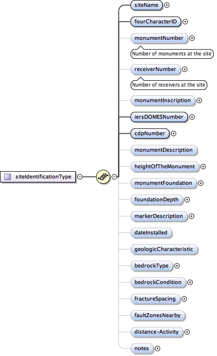
<element minOccurs="0" name="monumentNumber"><annotation><documentation>Number of monuments at the site</documentation></annotation><simpleType><restriction base="integer"><totalDigits value="1"/></restriction></simpleType></element>
<element minOccurs="0" name="receiverNumber"><annotation><documentation>Number of receivers at the site</documentation></annotation><simpleType><restriction base="integer"><totalDigits value="1"/></restriction></simpleType></element>
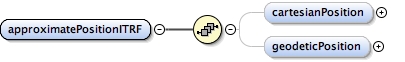
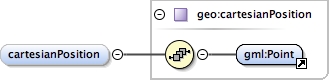
<element name="approximatePositionITRF"><complexType><!-- TODO Allow one or both, but not none of the allowed positioning points --><sequence><element name="cartesianPosition" type="geo:cartesianPosition" minOccurs="0"/><element name="geodeticPosition" type="geo:geodeticPosition" minOccurs="0"/></sequence></complexType></element>
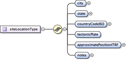
<complexType name="siteLocationType"><sequence><element name="city" type="string"/><element name="state" type="string"/><element name="countryCodeISO" type="geo:countryCodeType"/><!-- TODO: use gco --><element name="tectonicPlate" type="gml:CodeType"/><element name="approximatePositionITRF"><complexType><!-- TODO Allow one or both, but not none of the allowed positioning points --><sequence><element name="cartesianPosition" type="geo:cartesianPosition" minOccurs="0"/><element name="geodeticPosition" type="geo:geodeticPosition" minOccurs="0"/></sequence></complexType></element><element name="notes" type="string"/></sequence></complexType>